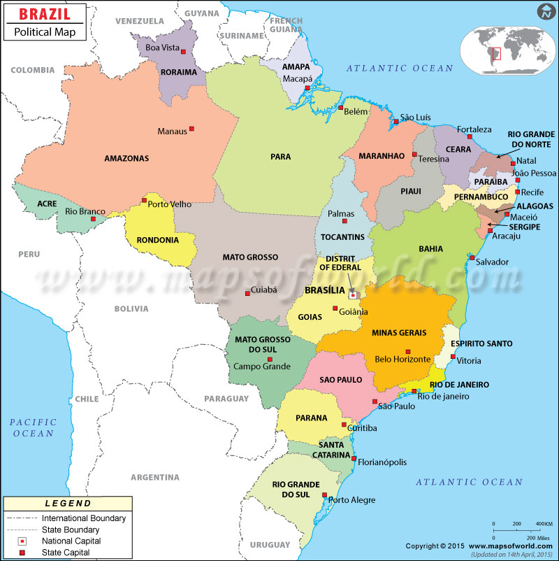
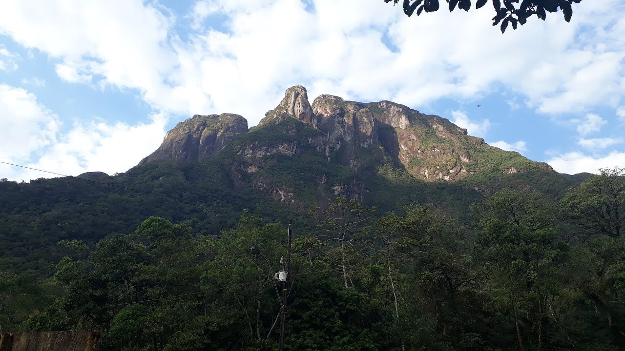
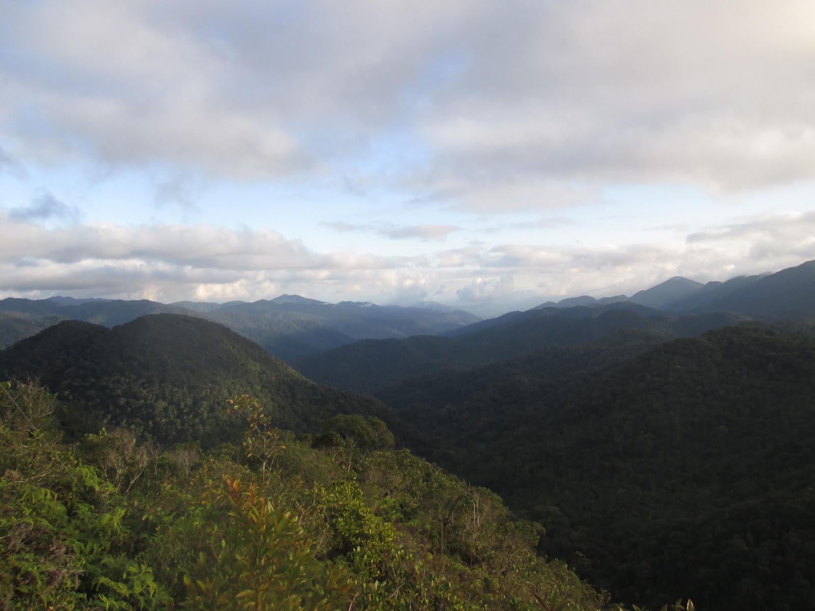
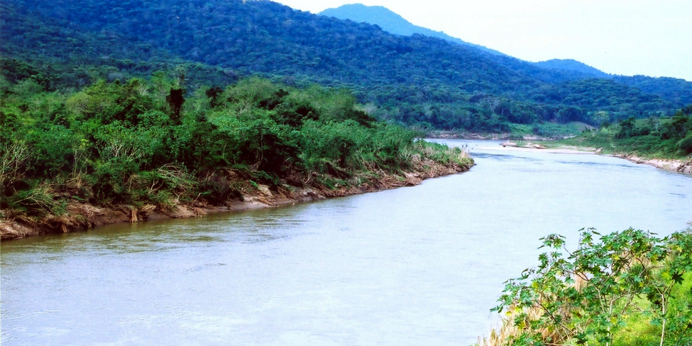
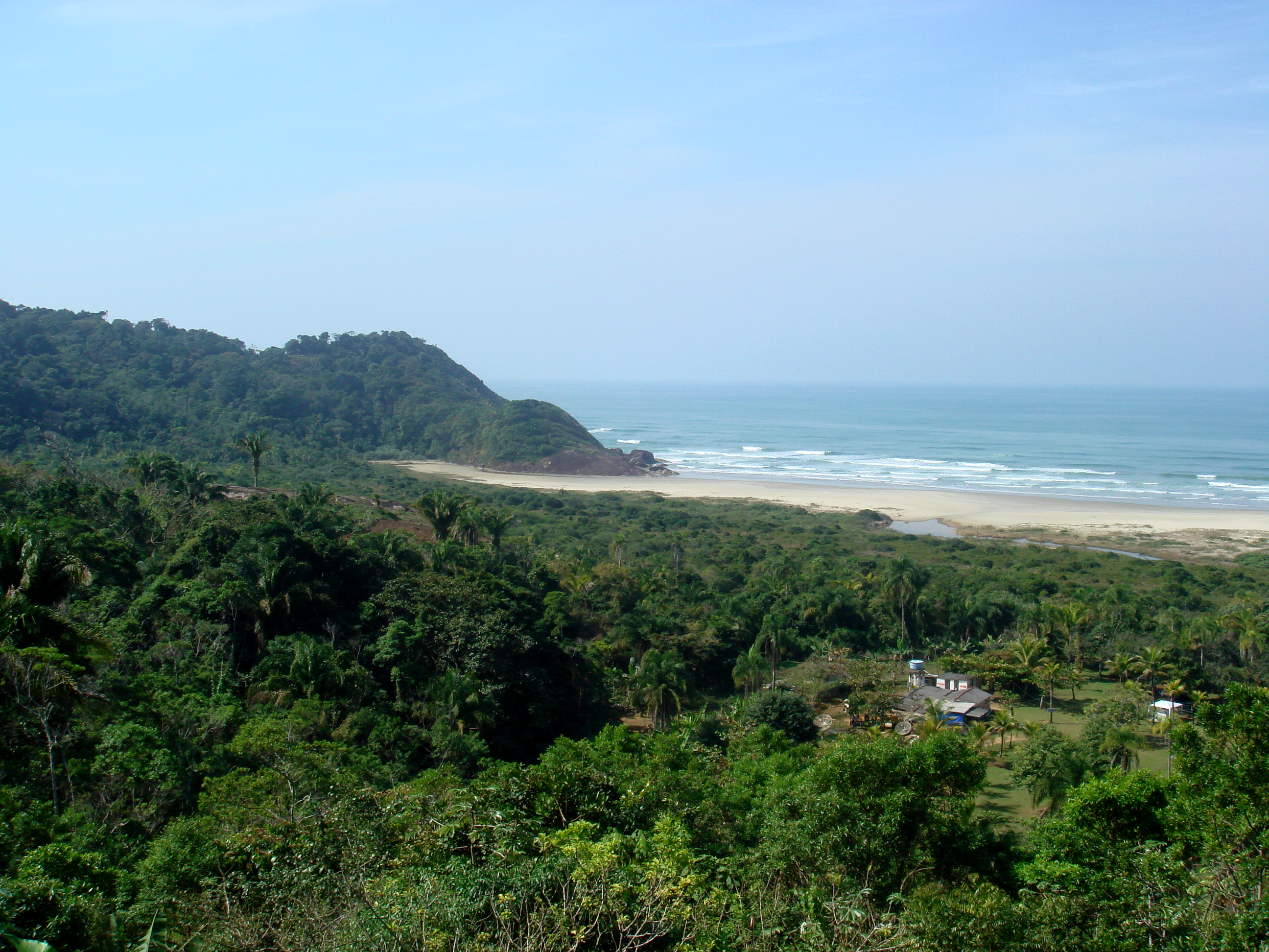
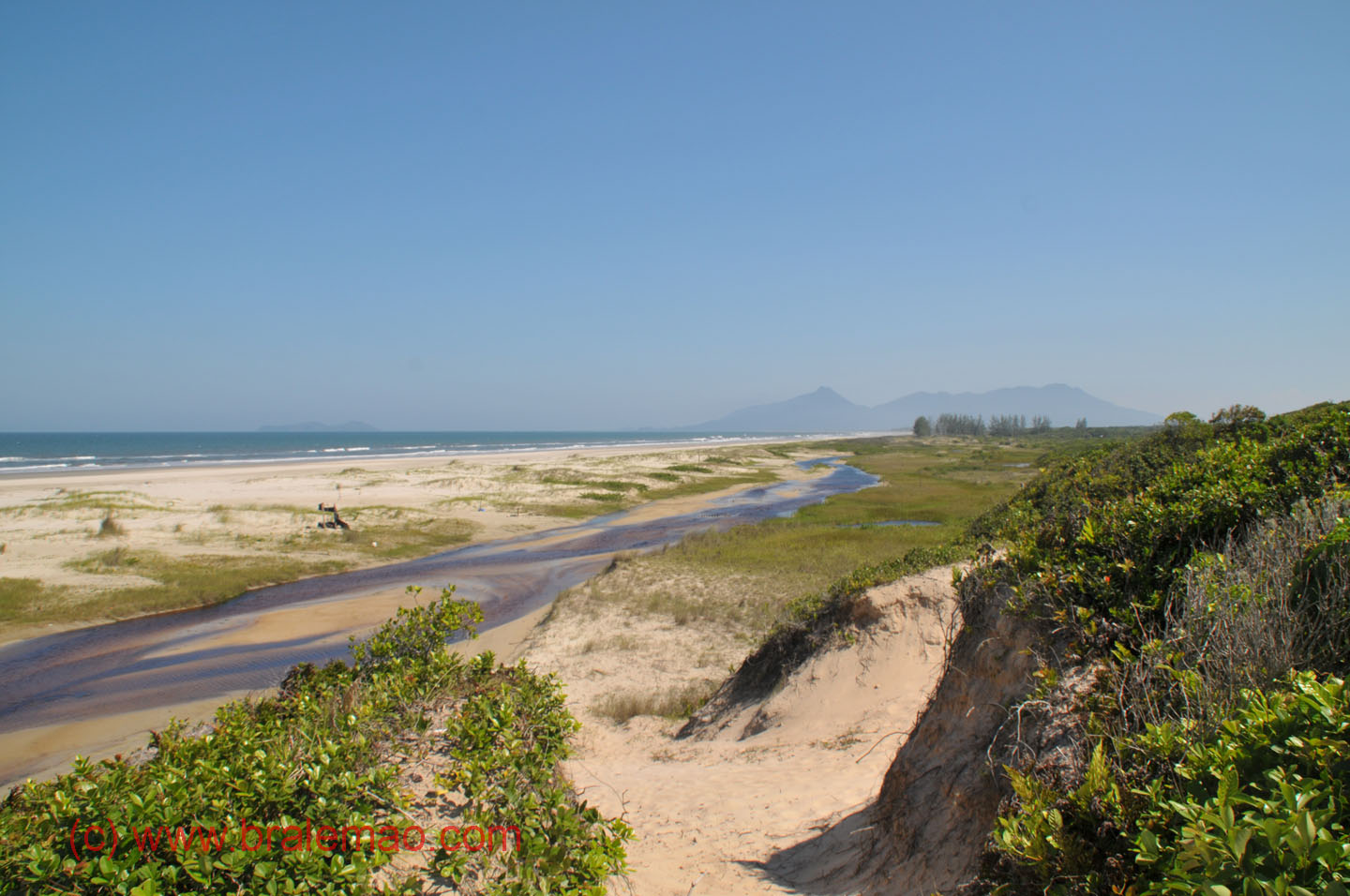
home click highlighted hovered text for more info, see help

Brazil UNESCO world heritage sites

Amazonas state [capital = Manaus]

Jau National Park in Novo Airao at Rua Antenor Carlos Frederico, 69 - Nossa Senhora Auxiliadora
It has two main areas: the Trombetas/Negro plateau and the lower western Amazon plateau. The higher area has hills with flat tops at 150 to 200 metres (490 to 660 ft) cut by valleys, while the lower area has altitudes of about 100 metres (330 ft). There are large areas of seasonally flooded land with poor drainage, and some permanent lakes.

Bahia state [capital = Salvador]

Historic Centre of Salvador see detail
The historic centre's main districts are Se, Pelourinho, Misericordia, Sao Bento, Taboao, Carmo and Santo Antonio. Pelourinho is characterized by its fidelity to the 16th-century plan, the density of its monuments and the homogeneity of its construction.
Una Biological Reserve in Maruim at Rodovia Ilheus km 45
This property contains great biological wealth and illustrates the evolution of the few remaining areas of Atlantic Forest in north-eastern Brazil. With a high rate of endemism and an evolutionary stage of great interest to science and conservation, its biodiversity reflects longstanding ties with the major forest ecosystems of the continent, now interrupted.
Veracel Station in Santa Cruz Cabralia at S16 10 0.00 W39 7 0.00
See above.
Pau-Brasil National Park + Ecological Station in Porto Seguro at S16 30 0.00 W39 18 0.00
See above.
Monte Pascoal National Park in Porto Seguro at Rua do Mamoeiro, 25
See above.
Discovery National Park in Prado at Rua 04, 31 - Novo
See above.

Espirito Santo state [capital = Vitoria]

Vale do Rio Doce Natural Reserve in Linhares, Vale at Rodovia BR-101, Km 121
See above.
Sooretama Biological Reserve in Linhares at Rodovia BR-101, Km 101
See above.

Goias state [capital = Goias]

Emas National Park in Mineiros at Rodovia GO 206, s/n - Chapadao do Ceu
Emas National Park shows a typical cerrado ecosystem; a treeless savannah with tall termite houses and an interesting amount of wildlife: the giant anteater, the maned wolf, giant armadillo, pampas deer and the namesake greater rhea, among others. Emas National Park also holds a small Jaguar population, perhaps consisting of about 10-12 animals. Only about 40% of the reserve, which covers 1,320 square kilometres (510 sq mi) in total, is good Jaguar habitat. Other larger mammals include puma, ocelot, Brazilian tapir, collared peccary, white-lipped peccary, marsh deer, red brocket, gray brocket, black howler monkey and capybara.
Historic Centre of Goias see detail
The urban layout is an example of the organic development of a mining town, adapted to the conditions of the site. Although modest, both public and private architecture form a harmonious whole, due to the coherent use of local materials and vernacular techniques.
Chapada dos Veadeiros National Park in Alto Paraiso de Goias at Rodovia GO 239, Km 36 - Vila de Sao Jorge
Chapada dos Veadeiros National Park is noted for its waterfalls. Those which range from 80 to 120 meters include the Corredeiras, Cannyon I, Cannyon II, the Carioquinhas Waterfall and the Jardim de Maitreya.
City of Brasilia on Monumental Axis (Prassa do Cruzeiro till Prassa dos Tres Poderes)
The city's planning is noteworthy for the remarkable congruence of Lucio Costa's urban design (the 'Plano Piloto') and Oscar Niemeyer's architectural creations, most powerfully reflected in the intersection between the monumental and thoroughfare axes, which stands as the determining factor of the city's urban scheme and underscores the representative character of Three Powers Square (Praca dos Tres Poderes) and the Esplanade of the Ministries (Esplanada dos Ministerios), also manifest in the geometry of the National Congress and in the new approach to urban living embodied in the Neighborhood Units (Unidade de Vizinhanca) and their corresponding Superblocks (Superquadras).

Maranhao state [capital = Sao Luis]

Historic Centre of Sao Luis @
The singularity of the construction techniques employed is expressed in the elegance of the traditional Portuguese azulejos tile work applied both as insulation and decoration; in the modulated use of occupied and empty spaces reinforced by crafted stonework; and in the sharp contrast between the dense ornamentation of the fassades overhanging the streets and porches that open wide from side to side into interior patios, lined by a continuous series of venetians, lattices, and frames.

Mato Grosso state [capital = Cuiaba]

Pantanal Conservation Area in Porto Jofre at Pocone
Its notably rich in wildlife, with some areas harbouring what's believed to be the world's highest concentration of Jaguars. A drive along the Transpantaneira is also popularly regarded as one of the best wildlife viewing experiences in South America.

Mato Grosso do Sul state [capital = Campo Grande]

Pantanal Conservation Area in Corumba at Estrada Parque
Although it lacks the fame of the Transpantaneira, travellers along the Estrada Parque will often see capybara, jacare (in their thousand), giant anteaters, anacondas and tderse birdlife. Jaguars are also sometimes seen but are rare, requiring considerable luck.

Minas Gerais state [capital = Belo Horizonte]

Historic Centre of Diamantina @
The Baroque architecture differs from that of other Brazilian towns in being of wood, and is distinguished by its geometry and details indicating transference on a modest scale of Portuguese architectural features. Churches have similar colours and textures as civil buildings, and most have only one tower. The regularly aligned 18th and 19th century semi-detached houses with one or two floors are painted in bright colours on a white ground, and contrast with the grey flagstone paving of the streets.
Modern Ensemble in Pampulha at Pampulha Lake
The Ensemble reflects the way principles of modern architecture that had evolved in the first decades of the 20th century were freed from rigid constructivism and adapted organically to reflect local traditions, the Brazilian climate and natural surroundings.
Historic Town of Ouro Preto @
Along the original winding road and within the irregular layout following the contours of the landscape lie squares, public buildings, residences, fountains, bridges and churches which together form an outstanding homogenous group exhibiting the fine curvilinear form of Baroque architecture.
Bom Jesus Sanctuary in Congonhas at Praça do Santuário, S/n - Centro
Dating from the second half of the 18th century, the church with its magnificent Italian rococo interior is a masterpiece of the Baroque style reflecting in its architecture and ornamentation the transition period in which it was built. The soapstone statues together with the polychrome wooden sculptures depicting scenes of Christ's Passion housed in the chapels stand as a crowning achievement of the creative genius of Francisco Antonio Lisboa, Aleijadinho, who bequeathed to humanity a truly impressive body of work.

Parana state [capital = Curitiba]

Lauraceas State Park in Tunas do Paraná on BR-476
Integral conservation unit with approximately 27,524ha of dense rainforest and mixed rainforest. It is one of the best preserved parks in the state of Paraná. Mountainous area, has numerous caves. The fauna, like the vegetation, is quite diverse, featuring endangered species, such as the purple-breasted parrot and the jaguar.
Serra da Graciosa Turistical Preservation in Quatro Barras on Graciosa Road PR-410
The road goes through the most pristine stretch of Atlantic Forest of Brazil , marked by the tropical forest and the beautiful streams that are born in the Serra do Mar
Pico do Marumbi State Park in Morretes on Estrada das Prainhas
There are three historic hiking trails that descend from the Curitiba plateau to the coastal lowlands: Arraial, Itupava and Graciosa. In former times, these trails were used by Indians, Jesuits and Bandeirantes in order to transport gold, precious stones and later coffee to the port of Paranaguá. Further hiking trails explore some of the exuberant waterfalls in the region such as Roseira, Véu da Noiva or Salto dos Macacos.
Pau Oco Turistical Preservation Zone & State Park in Morretes Estrada do Mundo Novo do Nhaia
The park contains the Salto da Fortuna, a waterfall that may be reached by a trail taking about four hours round trip. The fall is 50 metres (160 ft) high and has a large natural pool at its base where visitors may bathe. A local guide is required. The trail is of medium difficulty, crosses rivers, and includes sections and ruins of the old Arraial Colonial Route, now replaced by BR-277. The Arraial Colonial Way was opened between 1586 and 1590. There is an old chapel used by the miners of that time to request protection on their expeditions into the Serra do Mar.
Roberto E Lange State Park in Morretes
As of 2016 the park was not open to visitors.
State Park in Paranagua at Ilha do Mel
The highlights of Ilha do Mel are the Gruta das Encantadas, the Lighthouse of Conchas and the Fortress of N. S. dos Prazeres, all open to public visitation.
Ecological Station in Paranagua at Guaraguacu
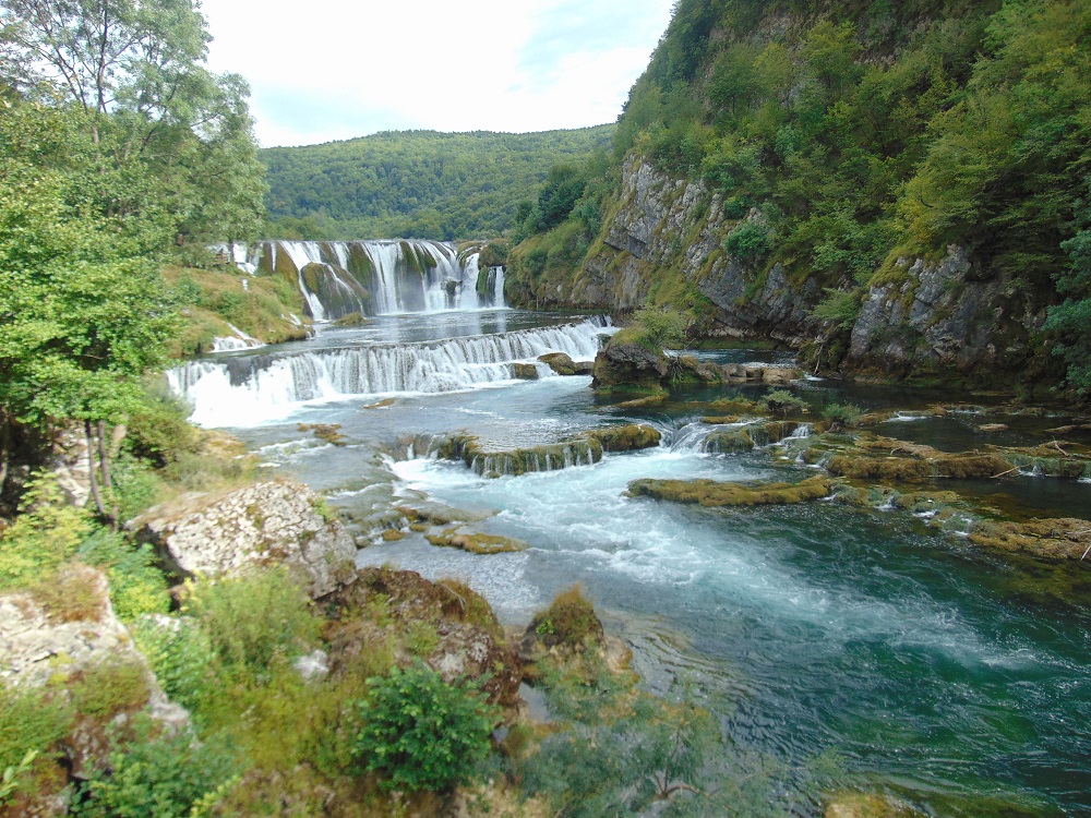
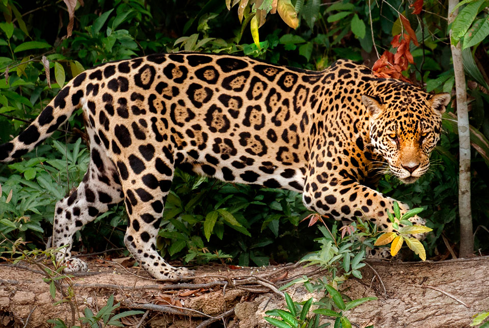
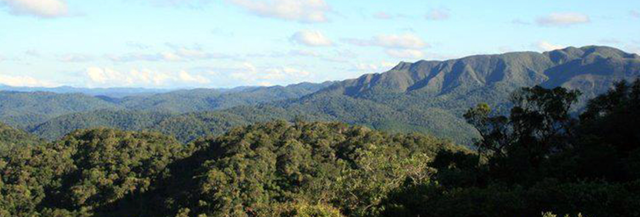
The reserve area contains ecosystems of relevant scientific value, which must be preserved in their entirety, and may be objects of biological and ecological research or studies, not involving tourism or recreational activities.
Salto Morato reserve in Guaraquecaba on Estrada Pr 405
It includes alluvial, submontane, montane and high montane formations. It also protects landscapes of rare beauty, such as the Garacui and Morato mountains and the Salto Morato waterfall, with a height of about 120 metres (390 ft) It is home to a significant number of endemic species of birds. 646 vascular plant species have been identified as well as 93 mammal species, 325 bird species, 36 reptile species, 61 amphibian species and 55 fish species. The reserve is part of the Lagamar Mosaic of conservation units. Researchers have found two new species of fish and a new species of three-toed frog. There is a 100-year-old fig tree, the Figueira do rio Engenho, whose roots form a natural bridge over 6 metres (20 ft) of the Ingenio River.
Ecological Station in Guaraquecaba at R. Paulo Miranda, nº 10
The unit covers areas of mangroves to the west of the Baia dos Pinheiros, to the north of the Baia de Guaraquecaba and to the west of the Enseada do Benito, as well as the islands of Laranjeiras, Rabelo, Pavoca, Sambaqui, Bananas and Galheta.
Superagui National Park in Guaraquecaba at Ilha do Superagui
The park comprises the islands of Superagüi, das Peças, Pinheiro, Pinheirinho and a part of the continent called Vale do Rio dos Patos.
Iguazu National Park in Foz de Iguazu Puerto Iguazu
The most spectacular sightseeing of the park is the Iguazu Falls, which form a 2,700m wide semicircle, while the water falls from a height of 72m. The number of waterfalls ranges from 150 and 300 depending on the Iguazu river flow. Besides the exuberant waterfalls, there are other attractions such as rich fauna, the Poco Preto (the Black Well), the Macuco Waterfall, the Visitors Center, the Santos Dumont Statue, a homage paid by VASP (a defunct airline company) to the "Father of Aviation", who lent all his prestige and efforts in turning the falls area into a National Park.

Pernambuco state [capital = Recife]

Historic Centre of Olinda see detail
Olinda became a remarkable nucleus, first as an economic, architectural and artistic centre, and later as a centre for the renewal of ideas. The harmonious balance between its buildings, gardens, convents, numerous small passos (chapels) and about twenty baroque churches all contribute to the Historic Centre of the Town of Olinda's particular charm.

Pernambuco island

Atlantic Island of Fernando de Noronha @
The main island, from which the group gets its name, makes up 91% of the total area; the islands of Rata, Sela Gineta, Cabeluda and Sao Jose, together with the islets of Leao and Viuva make up the rest. The central upland of the main island is called the Quixaba.

Piaui state [capital = Teresina]

Serra da Capivara National Park in Sao Raimundo Nonato at Rua Doutor Luiz Paixao, 188 * Milonga
Many of the numerous rock shelters in the Serra da Capivara National Park are decorated with rock paintings, some more than 25,000 years old.

Rio de Janeiro state [capital = Rio de Janeiro]

Carioca Landscapes in Rio de Janeiro see detail
The property encompasses all the key natural, structural elements that have constrained and inspired the development of the city. These stretch from the highest points of the mountains of the Tijuca National Park with its restored Atlantic forest, down to the sea, and include the Botanical Gardens established in 1808, Corcovado mountain, with its statue of Christ, and the chain of dramatic steep green hills, Sugar Loaf, Pico, Leme and Gloria, around Guanabara Bay, as well as the extensive designed landscapes on reclaimed land along Copacabana Bay which, together with Flamengo and other parks, have contributed to the outdoor living culture of the city.
Sitio Roberto Burle Marx in Barra Guaratiba at Estr. Roberto Burle Marx 2019
By the end of the 1960s, the site housed the most representative collection of Brazilian plants, alongside other rare tropical species. In the site, 3,500 cultivated species of tropical and subtropical flora grow in harmony with the native vegetation of the region, notably mangrove swamp, restinga (a distinct type of coastal tropical and subtropical moist broadleaf forest) and the Atlantic Forest.
State Park in Ilha Grande at Avenida Nacib Monteiro de Queiroz, Vila do Abraao
The island is made up of mountains with small plains irrigated with dozens of streams of clear water, with pools, rapids and waterfalls. More than 90% of the park is covered by Atlantic Forest. There are also restingas, heaths and mangroves. The island has eight beautiful beaches, separated by section of rocky shore and cliffs that plunge into the sea. The surrounding marine habitat supports a rich marine life. There are archaeological remains of tools and middens from 3,000 years ago. Of more recent date there is an old lighthouse, aqueduct, dam and hydroelectric power plant, the ruins of two prisons, stone paths from the colonial era and several ruined farmhouses.
Biological Reserve in Ilha Grande at Praia do Sul
The reserve is open only for educational or research purposes. About half of the reserve is covered in dense Atlantic Forest, with many species of flora and fauna including parrots, otters, woodpeckers, shore birds, monkeys, armadillos, pacas and snakes. There is a rich variety of rainforest trees and large mangroves.
Serra da Bocaina National Park in Sao Jose do Barreiro on Rodovia Estadual Francisca Mendes Ribeiro, s/n
The Serra da Bocaina National Park, due to its size and great altitude variation, has varied landscapes and several natural attractions such as beaches, natural pools, rivers, waterfalls, peaks and lookouts, not to mention the rich flora and fauna, typical of Mata Atlantic. There are also many attractions of historical and cultural interest, such as the paths and trails of gold that cross it, reminiscent of the tropeiros era, as well as the rustic and caiçara culture preserved in the mountainous and coastal portion, respectively.
Perpetual Defender's Fort in Paraty at Avenida Orlando Carpinelli, 440 - Pontal
The Forte Defensor Perpetuo stood on the initial site of the city, at the top of the Vila Velha hill, from 1703 onwards. The court was interested in ensuring the defence of the city and of the route to Minas. The fort was part of a defensive curtain which included another six elements composed of small forts and batteries scattered across the islands and along the coast.
Historic Center of Paraty Rua Domingos Gonçalves de Abreu 111-145
In the late 17th century, Paraty was the end-point of the Caminho do Ouro (Gold Route), along which gold was shipped to Europe. Its port also served as an entry point for tools and African slaves, sent to work in the mines. A defence system was built to protect the wealth of the port and the town. The historic centre of Paraty has retained its 18th century plan and much of its colonial architecture dating from the 18th and early 19th centuries.
Cairucu Environmental Protection Area in Paraty at R. Glauber Rocha, n 2077
The region includes an important remnant of the Atlantic Forest biome including the various transitions from coastal mangroves to humid tropical forest on the hillsides.

Rio Grande do Norte state [capital = Natal]

Atlantic Island in Atol das Rocas
The atoll consists mainly of coral and red algae. The coral ring is almost closed, with a 200 metres (660 ft) wide channel on the North side and a much narrower channel on the West side. The atoll and surrounding waters are contained in the Atol das Rocas Biological Reserve. The reserve it is currently used solely for scientific research.

Rio Grande do Sul state [capital = Porto Alegre]

Jesuit Missions of the Guaranis in Sao Miguel das Missoes on Rua Sao Miguel
These are the impressive remains of Jesuit Mission settlements established in the 17th and 18th centuries on lands originally occupied by Guarani indigenous communities. In Brazil, the ruins of the Sao Miguel Arcanjo church constitute the most intact and complete structure among this period's designated heritage properties.

Sao Paulo state [capital = Sao Paulo]

Carlos Botelho State Park in Sao Miguel Arcanjo at Rodovia Nequinho Fogaca SP 139, km 78,4, s/n, Abaitinga
The vegetation is mainly montane and submontane rainforest. In the highest parts of the park there are small areas of dense high montane rainforest and alpine meadows on shallow and stony soils. There is dense lowland rainforest in the areas below 50 metres (160 ft).
Ecological Station in Ribeirao Grande on Xitue
There are two main trails in the ESEC. On the Xitue trail the bamboo Guadua tagoara dominates, with more developed vegetation in the valleys of the small stream that drain the area. On the Rio das Almas trail, which follows the das Almas River, there are more stretches with large trees.
Intervales State Park in Ribeirao Grande at Estrada Municipal, km 25
Vegetation is mainly rainforest. Towards the center of the park, where the Serra de Paranapiacaba forms the watershed between the Ribeira do Iguape and Paranapanema basins, more of the flora belong to seasonal semi-deciduous forest.
Alto Ribeira Touristic State Park in Iporanga at Rodovia SP-165, Km 156
The park has one of the largest concentrations of caverns on the planet — more than 4300 — in a region of untouched Atlantic forest covering mountains and ridges. This natural heritage site is made up of palaeontological, archaeological, and historical sites, not to mention the extreme biodiversity and speleological richness to be found in the region.
Jacupiranga State Park in Jacupiranga on Rodovia SP-193
It is the second largest conservation area in São Paulo having a total area of approximately 150,000 hectares (1,500 km2.), and contains large tracts of Atlantic Forest.
Abaixo (Campina do Encantado) State Park in Pariquera-Acu at Estrada da Fazenda Ouro Verde | Braco Preto
The park holds a peat bog over 6 metres (20 ft) thick. The name "Campina do Encantado" (Enchanted Field) is due to the peat generating methane gas which can burn with a flame shooting from the ground up to 80 centimetres (31 in) high.
Serra do Itapitangui (e Mandira) Wild Life Zone in Itapitangui on Sp-193
From mountains covered by dense forests, down to wetlands, coastal islands with isolated mountains and dunes, the area comprises a rich natural environment of great scenic beauty.
Ilha do Cardoso State Park in Cananeia at Avenida Beira Mar | Morro Sao Joao
It preserves a large area of Atlantic Forest on the Ilha do Cardoso, an island, and includes marshes and mangroves that form an important breeding area for marine life. Visitors may reach the island by boat and stay in one of the villages. They may visit the beaches or follow trails into the interior, where there are waterfalls and natural pools.
Ecological Stations in Iguape at Jureia-Itatins + Chauas
The Banhados de Iguape Ecological Station (ESEC) covers an area of 16,588.64 hectares (40,991.4 acres) of mangrove swamp in southern São Paulo Visits are only allowed for environmental education and for scientific research.
Wild Life Zone in Ilha Comprida at Av. Dois Ac Al Porto De Paranagua, 945
The Ilha Comprida Environmental Protection Area is in the Atlantic Forest biome, and contains restinga forest, dunes, beaches and mangroves. It is one of the last complexes of such ecosystems on the coast, a nursery of South Atlantic marine and terrestrial species, used by over 30 species of migratory birds, and the location of archaeological remains.

Sergipe state [capital = Aracaju]

Sao Francisco Square in Sao Cristovao on Praca Sao Francisco
It may be considered a remarkable symbiosis of the urban planning of cities of Portugal and Spain. Relevant civil and religious institutional buildings, the main one being the complex of the Church and Convent of Sao Francisco, surround the square.