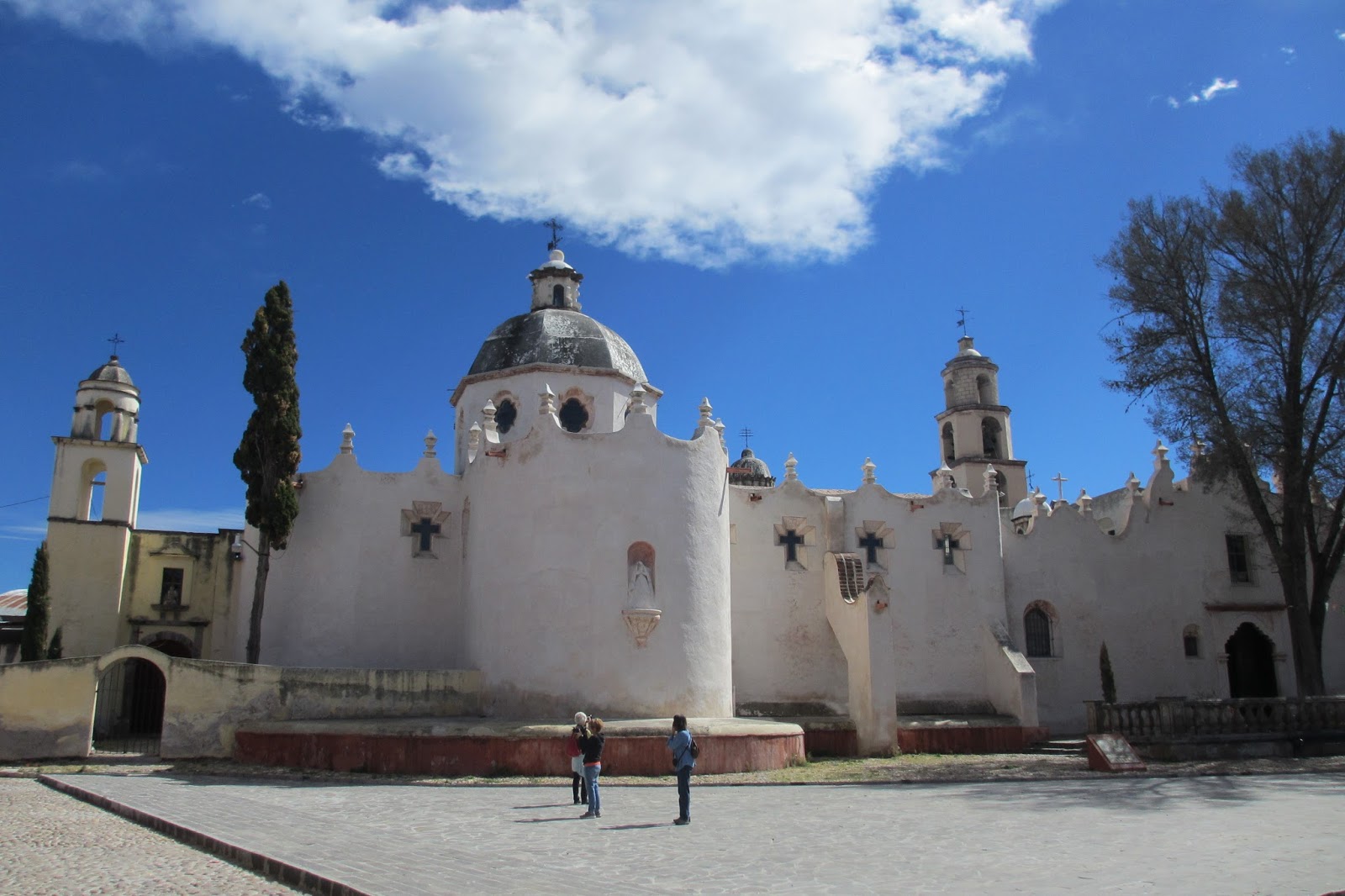
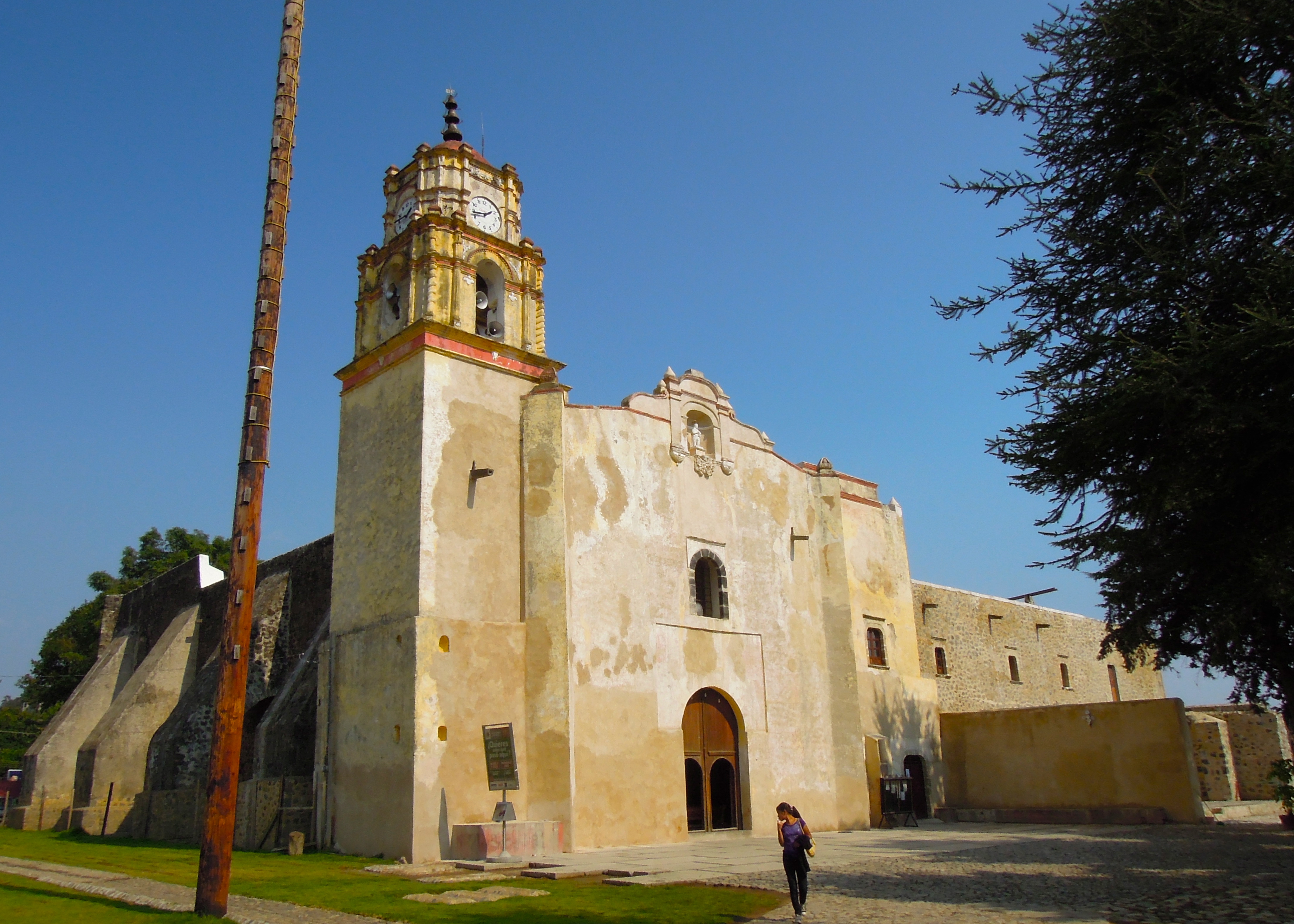
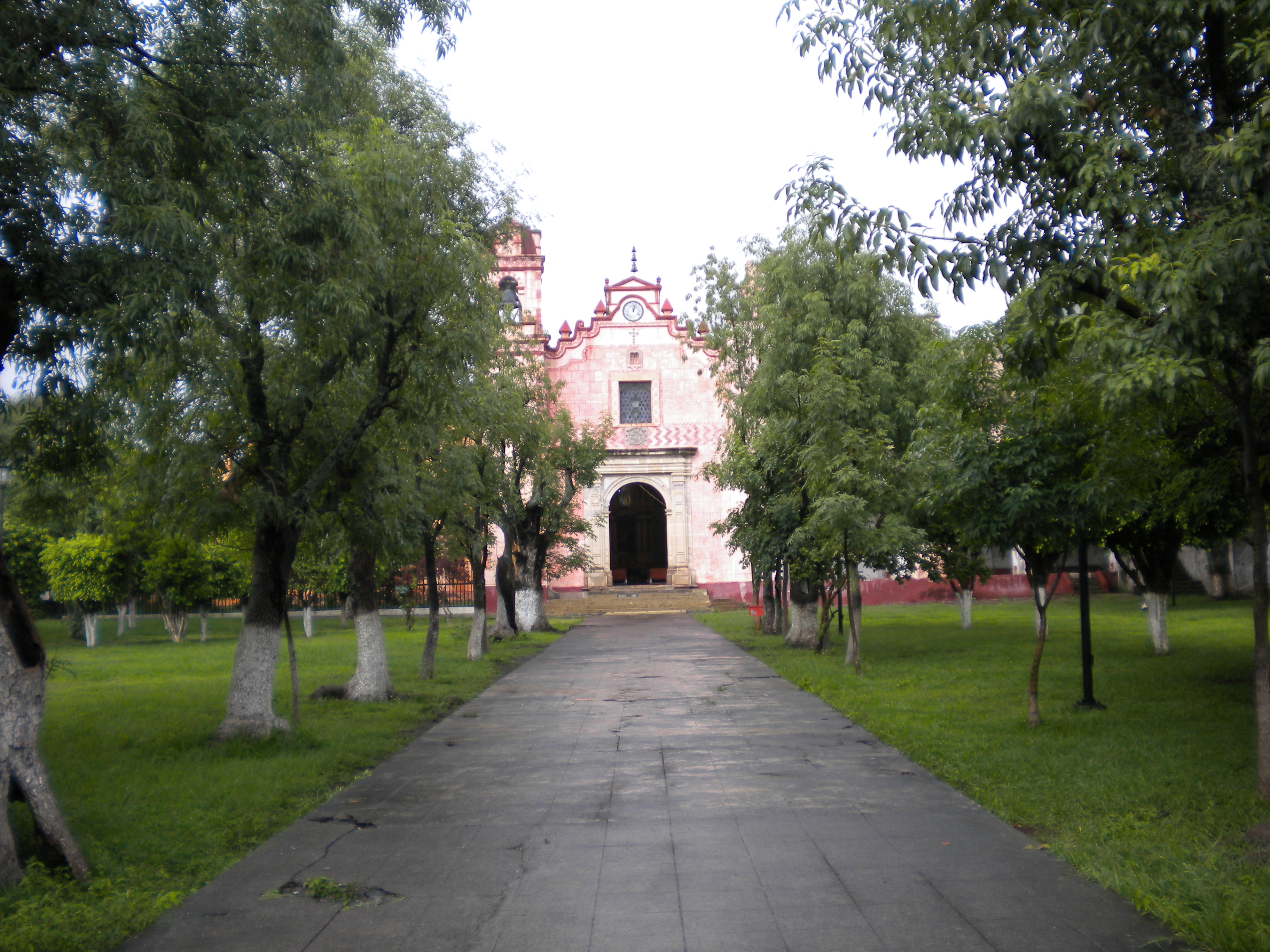
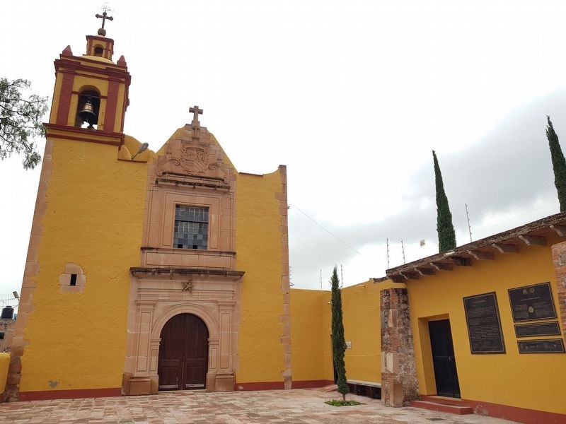
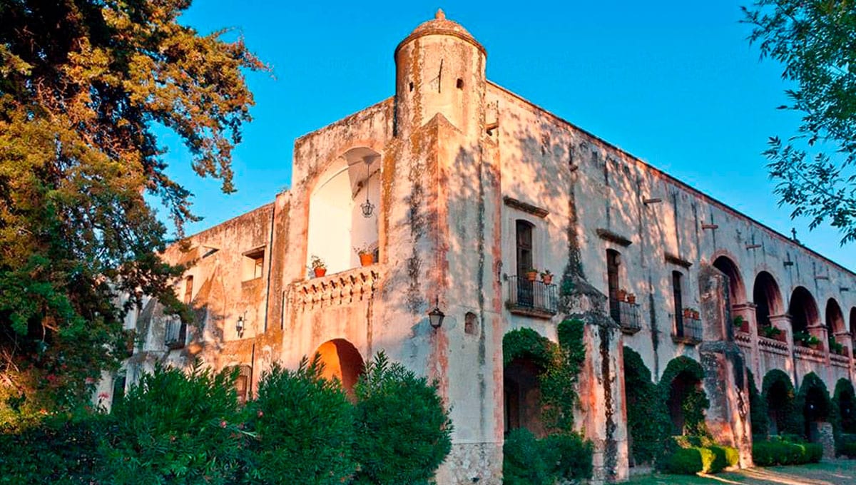
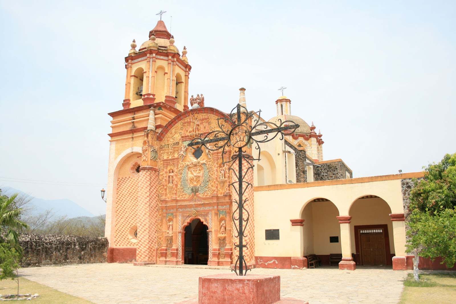
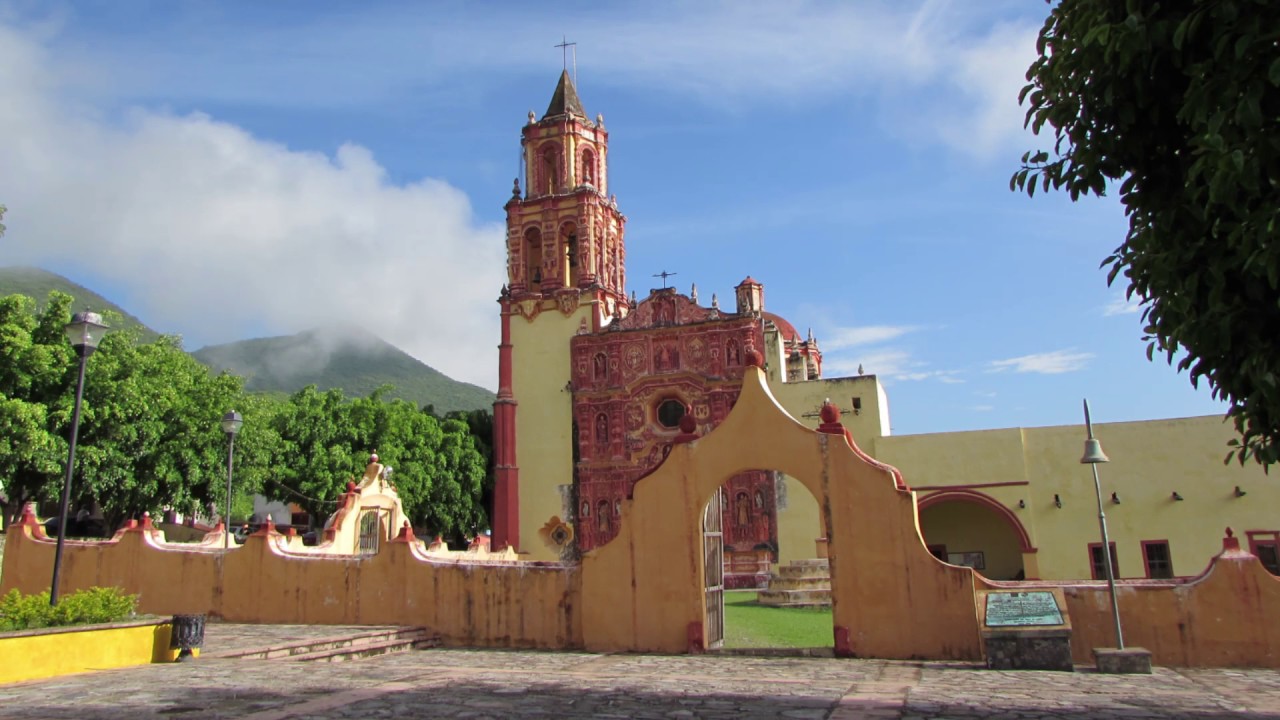
home click highlighted hovered text for more info, see help

Mexico UNESCO world heritage sites

Aguascalientes state [capital = Aguascalientes]

Former hacienda in Pabellon de Hidalgo
An ensemble of sites along the southern part of the Camino Real de Tierra Adentro, including examples of buildings, architectural and technological ensembles, illustrate a significant stage in human history - the Spanish colonial exploitation of silver and the transformation of associated rural and urban landscapes.
Historic ensemble of Aguascalientes
See above.
Ex-Hacienda of Penuelas in Aguascalientes on Mexico 45
See above.
Ex-Hacienda of Cieneguilla in Aguascalientes on Ruta Rural
See above.

Baja California Norte state [capital = Mexicali]

Archipelago of San Lorenzo near Bahia de los Angeles
The park is comprised by the Archipelago islands of San Lorenzo, Las Animas, Salsipuedes, Rasa, and Partida with the surrounding maritime border of the islands with a total area of 50,442 hectares. The Archipelago islands are surrounded by deep, cold water rich in nutrients in the center part of the Gulf of California also known as the Sea of Cortez. Most of the park is comprised by maritime area. The small terrestrial portion consists of rugged islands with irregular coastline eroded with many sea cliffs.

Baja California Sur state[capital = La Paz]

Rock Paintings of Sierra de San Francisco in Reserva de la Biosfera El Vizcaino
They are remarkably well-preserved because of the dry climate and the inaccessibility of the site. Showing human figures and many animal species and illustrating the relationship between humans and their environment, the paintings reveal a highly sophisticated culture. Their composition and size, as well as the precision of the outlines and the variety of colours, but especially the number of sites, make this an impressive testimony to a unique artistic tradition.
El Vizcaíno marine and coastal belt in Reserva de la Biosfera El Vizcaino
Speciation both on land in the many islands and in the Gulf has resulted in a notable diversity of life forms with a high degree of endemism. The productivity of the Gulf also leads an extraordinary natural abundance of many marine species. There are some 900 species of fish, around 90 of them endemic, and roughly one third of the World's marine mammals occur within the property.
Whale Sanctuary of El Vizcaino in Reserva de la Biosfera El Vizcaino
The coastal lagoons of Ojo de Liebre and San Ignacio are important reproduction and wintering sites for the grey whale, harbour seal, California sea lion, northern elephant-seal and blue whale. The lagoons are also home to four species of the endangered marine turtle.
Bahia de Loreto National Park in Loreto @
Five main islands serve as the park's chief focal points and tourist destinations: Isla Coronados, Isla del Carmen, Isla Danzante, Isla Monserrat, and Isla Santa Catalina. Though the municipality of Loreto is not within park boundaries, it is the primary starting point for tours of the park and is considered a major influence on the area's ecology.
Balandra Zone of Ecological Conservation in La Paz at Callejon Puerto Pichilingue 7 km
La Paz is unique as a whale shark destination for its proximity to the whale shark observation zone and efforts undertaken by tour operators, regulatory agencies and civil society to responsibly manage this extraordinary experience. You’ll also visit Balandra Bay, a natural protected area with pristine beaches bordered by mangroves and the rugged beauty of the surrounding hills and desert.
Cabo Pulmo in Los Cabos @
Bahía Pulmo is home to the oldest of only three coral reefs on the west coast of North America. Estimated to be 20,000 years old, it is the northernmost coral reef in the eastern Pacific Ocean.
Cabo San Lucas in Los Cabos @
Cabo has been rated as one of Mexico's top 5 tourist destinations; it is known for its beaches, scuba diving locations, balnearios, the sea arch El Arco de Cabo San Lucas, and marine life.

Campeche state [capital = Campeche]

Historic Fortified Town of Campeche @
Campeche is a typical example of a harbour town from the Spanish colonial period in the New World. The historic centre has kept its outer walls and system of fortifications, designed to defend this Caribbean port against attacks from the sea.
Ancient Maya City and Protected Tropical Forests of Calakmul in Xpujil @
This property, while nowadays almost uninhabited and covered by tropical forest, is the heartland of the area in which, from the mid-first millennium B.C. to about A.D. 1000, the Maya civilization reached its climax, but where it also suffered the most dramatic downfall, resulting in an almost complete abandonment of formerly flourishing settlements. Since the area has, thereupon, remained virtually depopulated, it represents an exceptional testimony to a long-living civilization, offering possibilities for archaeological and ecological research and presentation of its results.

Chiapas state [capital = Tuxtla Gutierrez]

Pre-Hispanic City of Palenque at Carretera a Palenque- Zona Archaeologica Km. 8
The archaeological site of Palenque in the state of Chiapas is one of the most outstanding Classic period sites of the Maya area, known for its exceptional and well conserved architectural and sculptural remains. The elegance and craftsmanship of the construction, as well as the lightness of the sculpted reliefs illustrating Mayan mythology, attest to the creative genius of this civilization.

Colima state [capital = Colima]

Archipelago of Revillagigedo on San Benedicto + Socorro + Roca Partida + Clarion
This archipelago is part of a submerged mountain range, with the four islands representing the peaks of volcanoes emerging above sea level. The islands provide critical habitat for a range of wildlife and are of particular importance for seabirds. The surrounding waters have a remarkable abundance of large pelagic species, such as manta rays, whales, dolphins and sharks.

Chihuahua state [capital = Chihuahua]

Archaeological Zone in Nuevo Casas Grandes at Paquime
It is the largest archaeological zone that represents the peoples and cultures of the Chihuahua Desert. Its development took place in the years 700-1475 and it reached its apogee in the 14th and 15th centuries. Its architecture marked an epoch in the development of the architecture of the human settlement of a vast region in Mexico and illustrated an outstanding example of the organization of space in architecture.
Town of Valle de Allende
An ensemble of sites along the southern part of the Camino Real de Tierra Adentro, including examples of buildings, architectural and technological ensembles, illustrate a significant stage in human history - the Spanish colonial exploitation of silver and the transformation of associated rural and urban landscapes.

Durango state [capital = Durango]

Temple of San Miguel in Villa Ocampo
See above.
Former hacienda of the Limpia Concepcion in Canutillo
See above.
Town of Inde
See above.
Chapel of San Mateo of the Former hacienda in La Zarca
See above.
Town of San Pedro del Gallo
See above.
Stretch of the Camino Real from San Pedro del Gallo to Nazas
See above.
Town of Mapimi
See above.
Mine of Ojuela in Mapimi
See above.
Architectonic ensemble of Nazas
See above.
Chapel of the Refugio of the former hacienda in Cuencame at Cuatillos
See above.
Temples in Cuencame at Francisco Sarabia, Alamedas
Tourist attractions of the city are the temple of San Antonio de Padua, the Temple of the Virgin of Solitude and the Sanctuary of the Virgin of Guadalupe.
Temple in San Jose de Avino
An ensemble of sites along the southern part of the Camino Real de Tierra Adentro, including examples of buildings, architectural and technological ensembles, illustrate a significant stage in human history - the Spanish colonial exploitation of silver and the transformation of associated rural and urban landscapes.
Chapel of San Antonio of the Former hacienda of Juana Guerra in Nombre de Dios on Carretera Sombrerete-Durango
See above.
Temples in Nombre de Dios at town center
See above.
Cave of Las Mulas de Molino in Nuevo Ideal
See above.
Historic centre of Durango see detail
The city is noted for its colonial architecture, including Baroque, attesting to its relatively early colonization by the Spanish. The historic center contains the largest concentration of historic monuments in northern Mexico.
Former hacienda of San Diego de Navacoyan in Durango at Puente del Diablo
It is signposted from the main road but there are no more signs and the El Señor de Santa Teresa Chapel (right) and opposite, the main building of the Hacienda de San Diego de Navacoyán, built in the mid-18th century, are not easy to find.
Chapels of the former haciendas of La Inmaculada Concepcion + La Limpia Concepcion in Rodeo on routa 45 south
An ensemble of sites along the southern part of the Camino Real de Tierra Adentro, including examples of buildings, architectural and technological ensembles, illustrate a significant stage in human history - the Spanish colonial exploitation of silver and the transformation of associated rural and urban landscapes.

Guanajuato state [capital = Guanajuato]

Historic Town of Guanajuato @
Founded by the Spanish in the early 16th century, Guanajuato became the world's leading silver-extraction centre in the 18th century. This past can be seen in its 'subterranean streets' and the 'Boca del Inferno', a mineshaft that plunges a breathtaking 600 m. The town's fine Baroque and neoclassical buildings, resulting from the prosperity of the mines, have influenced buildings throughout central Mexico.
Bridge of El Fraile in Caldera at Celaya-Dolores Hidalgo
An ensemble of sites along the southern part of the Camino Real de Tierra Adentro, including examples of buildings, architectural and technological ensembles, illustrate a significant stage in human history - the Spanish colonial exploitation of silver and the transformation of associated rural and urban landscapes.
Protective town of San Miguel de Allende
The fortified town, first established in the 16th century to protect the Royal Route inland, reached its apogee in the 18th century when many of its outstanding religious and civic buildings were built in the style of the Mexican Baroque. Some of these buildings are masterpieces of the style that evolved in the transition from Baroque to neoclassical.
Former Royal hospital of San Juan de Dios in San Miguel de Allende at San Pedro 4, Centro
An ensemble of sites along the southern part of the Camino Real de Tierra Adentro, including examples of buildings, architectural and technological ensembles, illustrate a significant stage in human history - the Spanish colonial exploitation of silver and the transformation of associated rural and urban landscapes.
Bridge of San Rafael in San Miguel de Allende at A La Cieneguita
See above.
Sanctuary of Jesus Nazareno in Atotonilco on Calle Principal
The main feature of the complex is the rich Mexican Baroque mural work that adorns the main nave and chapels. This was chiefly the work of Antonio Martínez de Pocasangre over a period of thirty years. The mural work has led the complex to be dubbed the "Sistine Chapel of Mexico."
Bridge La Quemada in San Felipe on Mexico 51
See above bridge.

Hidalgo state [capital = Pachuca]

Aqueduct of Padre Tembleque in Tepeyahualco @
The hydraulic system is an outstanding example of water conduction in the Americas and integrates along its 48 kilometres’ extent impressive architectural structures, such as the main arcaded aqueduct at Tepeyahualco, which reaches a total height of 39.65m, with its central arch of 33.84m height. The system was built by Franciscan friars with support from the local communities and as a result is a unique representation of the ingenious fusion of Mesoamerican and European construction traditions, combining the mestizo tradition with the tradition of Roman hydraulics. As an ensemble of canals and auxiliary structures, the system is exceptionally well-preserved and one branch remains operational up until today.
Former convent of San Francisco in Tepeji del Rio de Ocampo at Hidalgo 6, San Mateo 2da
The architectural ensemble has classical style elements distributed inside where there are soberly conjugated remains of mural painting with religious themes and large-format works executed by Juan Correa and Francisco Martínez , of which it is preserved, in the annexed chapel called El Sagrario , a canvas dated 1718, with the theme of La Purísima.
Stretch of the Camino Real from bridge of La Colmena to Former hacienda of La Canada on Camino Real
Stretch of the Camino Real.

Jalisco state [capital = Guadelajara]

Historic ensemble + bridge in Ojuelos
Ojuelos has a significant value in Colonial history in Mexico and North America, since its fortification is the only one which has survived to present day keeping its main structure as originally built in 1569.
Former hacienda of Cienega de Mata in Lagos de Moreno at Alvarez del Castillo
The church on the hacienda is larger than that seen in many mid-sized cities in Mexico. The owners were deeply tied to both the Church, as well as to politics.
Cemetery in Encarnacion de Diaz at Concordia 96, Santa Fe
The Senor de la Misericordia Cemetery is the oldest in the Los Altos region. Its construction was begun in 1826 as a patio surrounded by four corridors lined with crypts. In the center, there is a large chapel made of white sandstone. The fassade of this chapel has three arches and decorated with vegetative motifs and some animal figures. The interior contains a mural of a crucified Christ with Byzantine influence, called the Señor de la Misericordia (Lord of Mercy).
Historic centre of Lagos de Moreno at Jardin de los Constituentes
The city's modern history started on 31 March 1563, when it was founded as Villa de Santa María de los Lagos, by Captain Don Hernando Martel and Captain Don Pedro de Anda, along with 72 Spanish noble families, servants, and slaves. The city was renamed Lagos de Moreno in memory of insurgent General Pedro Moreno (1775-1817), a founding father of Mexico, who led forces against Spain in the War of Mexican Independence.
Hospicio Cabanas in Guadalajara at Calle Paseo Hospicio 8, San Juan de Dios
The Hospicio Cabanas was built at the beginning of the 19th century to provide care and shelter for the disadvantaged – orphans, old people, the handicapped and chronic invalids. This remarkable complex, which incorporates several unusual features designed specifically to meet the needs of its occupants, was unique for its time. It is also notable for the harmonious relationship between the open and built spaces, the simplicity of its design, and its size.
Agave Landscape and Ancient Industrial Facilities in Teuchitlan + El Arenal + Amatitan + Tequila @ @ @ @
The area encloses a living, working landscape of blue agave fields and the urban settlements of Tequila, Arenal, and Amatitan with large distilleries where the agave ‘pineapple' is fermented and distilled. The property is also a testimony to the Teuchitlan cultures which shaped the Tequila area from AD 200-900, notably through the creation of terraces for agriculture, housing, temples, ceremonial mounds and ball courts.

Mexico state [capital = Mexico City]

Floating Gardens of Xochimilco @
Xochimilco lies 28 km south of Mexico City. With its network of canals and artificial islands, it testifies to the efforts of the Aztec people to build a habitat in the midst of an unfavourable environment. Its characteristic urban and rural structures, built since the 16th century and during the colonial period; have been preserved in an exceptional manner.
Historic Centre of Mexico City see detail
Built in the 16th century by the Spanish on the ruins of Tenochtitlan, the old Aztec capital, Mexico City is now one of the world's largest and most densely populated cities. It has five Aztec temples, the ruins of which have been identified, a cathedral (the largest on the continent) and some fine 19th- and 20th-century public buildings such as the Palacio de las Bellas Artes.
Central University City Campus in Mexico City at Avenida Universidad 3000
The urbanism and architecture of the Central University City Campus of UNAM constitute an outstanding example of the application of the principles of 20th Century modernism merged with features stemming from pre-Hispanic Mexican tradition. The ensemble became one of the most significant icons of modern urbanism and architecture in Latin America, recognized at universal level.
Luis Barragan House in Mexico City at Ampliacion Daniel Garza
Built in 1948, the House and Studio of architect Luis Barragán in the suburbs of Mexico City represents an outstanding example of the architect’s creative work in the post-Second World War period. The concrete building, totalling 1,161 m2, consists of a ground floor and two upper storeys, as well as a small private garden. Barragán’s work integrated modern and traditional artistic and vernacular currents and elements into a new synthesis, which has been greatly influential, especially in the contemporary design of gardens, plazas and landscapes.
Pre-Hispanic City of San Juan Teotihuacan de Arista at Ecatepec Pirámides km.22 + 600
Built between the 1st and 7th centuries A.D., it is characterized by the vast size of its monuments – in particular, the Temple of Quetzalcoatl and the Pyramids of the Sun and the Moon, laid out on geometric and symbolic principles. As one of the most powerful cultural centres in Mesoamerica, Teotihuacan extended its cultural and artistic influence throughout the region, and even beyond.
Temple of San Francisco Javier in Tepotzotlan at Insurgentes 99, San Martin
This temple is one of the few examples of Baroque Churrigueresco novohispano that can still be seen. The external facade consists of two bodies and an auction, carved in gray chiluca stone. In the lower body there are sculptures that represent the glory of Christian marriage and the four evangelists.
Bridge of Atongo in Soyaniquilpan
Bridge on the Camino Real de Tierra Adentro.
Town of Aculco
Aculco is home to numerous historic sites, including the San Jeronimo and the "Garrido Varela" (a bullring), as well as the former residence of Miguel Hidalgo y Costilla.
Stretch of Camino Real from Aculco to San Juan del Rio
An ensemble of sites along the southern part of the Camino Real de Tierra Adentro, including examples of buildings, architectural and technological ensembles, illustrate a significant stage in human history - the Spanish colonial exploitation of silver and the transformation of associated rural and urban landscapes.

Michoacan state [capital = Morelia]

Historic Centre of Morelia on plaza de Armas
The central part of the Historic Centre of Morelia includes 249 monuments of prime importance, of which 21 churches and 20 civil constructions, which crystallize the architectural history of the city. The sobriety of the urban townscape is enhanced by many Baroque facades characteristic of the religious foundations, including the cathedral and the churches of Santa Rosa, de las Monjas and Guadelupe.
Monarch Butterfly Biosphere Reserve in Contepec + Chincua + El Campanario + Chivati + Huacal + Cerro Pelon
The overwintering concentration of butterflies in the property is a superlative natural phenomenon. The millions of monarch butterflies that return to the property every year bend tree branches by their weight, fill the sky when they take flight, and make a sound like light rain with the beating of their wings. Witnessing this unique phenomenon is an exceptional experience of nature.

Morelos state [capital = Cuernavaca]

Archaeological Monuments in Miacatlan at Zone of Xochicalco
Xochicalco is an exceptionally well-preserved example of a fortified political, religious and commercial centre from the troubled period of 650–900 that followed the break-up of the great Mesoamerican states such as Teotihuacan, Monte Albán, Palenque and Tikal.
Cathedral in Cuernavaca at corner of Hidalgo and Morelos Street
The overall form of this, which used to be only the inner sanctum of the monastery and its lands, was purposefully builhttps://www.viamichelin.com/web/Tourist-Attraction/Acatlipa-_-Xochicalco_Feathered_Serpent_Temple-7ddeee79f6e0t away from the population center to give a sense of isolation to both the monks and those visiting.
Ancient Convent of the Nativity in Tepoztlan at corner of Ignacio Zaragoza & Arq. Pablo Gonzalez
It was built between 1555 and 1580 by villagers of the old township of Tepoztlan. With a motif that highlights Dominican Temples, it has a large atrium, an open chapel, chapel posas or quadrangular vaulted structures located at the edge of the courtyard, the church, and convent.
Former convent of Santo Domingo de Guzman in Oaxtepec at Emperador 1
Earliest 16th-Century Monastery on the Slopes of Popocatepetl.
Temple and Former Convent of Saint John the Baptist in Tlayacapan at 2 de Abril 18, Barrio de Texcalpan
The main landmark is the former monastery of San Juan Bautista, which towers over all the other structures. It was built beginning the 1530s, along with 26 chapels scattered around the original town as part of the "spiritual conquest" of the area.
Temple and Former Convent of Saint William in Totolapan at Mariano Escobedo 21, San Agustin
The native population was evangelized by the Augustinians and the Monastery of San Guillermo was built in 1545, becoming one of the first colonial monasteries in Mexico.
Former Augustinian Convent of Apostel San Mateo in Atlatlahucan at Del Convento, San Mateo
With delimited atrium, temple, two level cloisters, porter and an open chapel, the building looks grand as ever, especially with the tall bell tower, bulrush façade and the Porfirian Clock.
Temple and Former Convent of Saint John the Baptist in Yecapixtla on Calle Sufragio Efectivo
The site of the church and former monastery of San Juan Bautista was a teocalli, or sacred precinct, dedicated to a god of commerce called Yacapitzauac. This teocalli was destroyed by the Spanish under Gonzalo de Sandoval when he captured and sacked the settlement in 1521. This teocalli and god were the center of the pre-Hispanic community. The Franciscans were the first to arrive in the 1520s to evangelize the local population and they built a small church on the site. However, this church was destroyed in a fire. The Augustinians took over evangelization in the 1530s and formally established the monastery, dedicated to John the Baptist.
Temple and Former Convent of Saint James the Apostle in Ocuituco at Ocuituco 103, Los Alacranes
Earliest 16th-Century Monastery on the Slopes of Popocatepetl.
Temple and Former Convent of Saint John the Baptist in Tetela del Volcan at Lopez Avelar 7, San Bartolo
The exterior has arcades that surround the complex but are partially hidden by trees. The upper parts of the walls around the complex are covered in paint, the lower floor of the cloister has figures depicted in the arches and walls. In the vaults over the walkways, there are numerous cherubs defeating evil spirits and some even fighting with each other.
Temple and Former Convent of Saint Dominic de Guzman in Hueyapan at Morelos 16, San Miguel
The monastery of Santo Domingo de Guzman It is one of the monasteries closest to the volcano. It was founded by the Dominicans but its cloister was built of adobe and wood with a tile roof instead of stone. It disintegrated relatively quickly due to the elements and was abandoned. It remains mostly closed to this day. Only the atrium area is open to visitors and this closes by 1pm each day. The austere facade of the main church survives and it has a notable Barorque niche.
Temple and Former Convent of the Immaculate Conception in Zacualpan de Amilpas at Galeana 14
Earliest 16th-Century Monastery on the Slopes of Popocatepetl.

Nayarit state [capital = Tepic]

Isabel island via San Blas @
There are numerous factors that make Isla Isabel such a diverse and phenomenal wildlife destination. Firstly, several ocean currents meet in the waters surrounding the volcanic outcrop. These nutrient-rich currents provide sustenance for a variety of marine-life, including the many thousand of seabirds that call this place home. Secondly, the mainland holds one of the largest and most biologically important mangrove stands on the central American coastline. These mangroves function as a sanctuary for fish and other animals that then make their way as adults across the channel to the coral reefs that surround the island. Coral reefs are rare in this part of the world and this makes for exceptional snorkeling and diving. Lastly, due to its previous inaccessibility to humans and the absence of natural predators, the wildlife is bizarrely unafraid of humans, allowing for a truly unforgettable experience.
Marias Islands via San Blas
Because of its isolation for over eight million years, Islas Marías' importance as an ecosystem is manifest in its function as a reservoir to Mexico of endemic species. Fifty-four species of land and marine fauna are protected under some risk category and of these, 19 are endemic. Regarding the flora, 11 endemic or restricted distribution taxa have been recorded, together with six species (one endemic) that are included in a risk category according to NOM-059-SEMARNAT-2001. Furthermore, the reserve is an important refuge, nesting and feeding site for large colonies of sea birds. The marine environment is highly productive, reflected in the great diversity of organisms to be found, such as coral reefs, reef-fish, sharks, rays, turtles and marine mammals.
Marietas islands via Puerto Vallarta @
Many species of seabirds use the location as feeding and breeding grounds, these include blue-footed boobies as well as the red-billed tropicbirds. It also has many different varieties of coral, which, in turn, is home to a large variety of reef fish species. The island ecosystem is also home to dolphins, Manta Rays and a number of tropical fish. Eels and many species of sea turtles are also found in the reefs and the many caves that dot the site. During the winter months humpback whales arrive at the islands and can be observed all through winter.

Oaxaca state [capital = Oaxaca]

Archaeological Site of Monte Alban in San Pedro Ixtlahuaca at Ignacio Bernal
The grand Zapotec capital flourished for thirteen centuries, from the year 500 B.C to 850 A.D. when, for reasons that have not been established, its eventual abandonment began. The archaeological site is known for its unique dimensions which exhibit the basic chronology and artistic style of the region and for the remains of magnificent temples, ball court, tombs and bas-reliefs with hieroglyphic inscriptions.
Historic Centre of Oaxaca @
A total of 1,200 historic monuments has been inventoried and listed. The major religious monuments, the superb patrician town houses and whole streets lined with other dwellings combine to create a harmonious cityscape, and reconstitute the image of a former colonial city whose monumental aspect has been kept intact.
Prehistoric Caves in Yagul + Mitla
Some of these shelters provide archaeological and rock-art evidence for the progress of nomadic hunter-gathers to incipient farmers. Ten thousand-year-old Cucurbitaceae seeds in one cave, Guilá Naquitz, are considered to be the earliest known evidence of domesticated plants in the continent, while corn cob fragments from the same cave are said to be the earliest documented evidence for the domestication of maize.

Puebla state [capital = Puebla]

Temple and Former Convent of the Assumption of Our Lady in Tochimilco at Plaza Principal 10
In the municipal seat of Tochimilco there is a very beautiful Temple and a former Franciscan convent of the Assumption of Our Lady was founded by Fray Diego de Olarte and built in 1560.
Temple and Former Convent of Saint Andrew in San Andres Calpan at Benito Juarez 206
This convent is considered a jewel of Novohispanic architecture, especially for its plateresque facade and the set of four chapels located at the ends of the atrium.
Temple and Former Convent of Saint Michael the Archangel in Huejotzingo at Av Cuauhtemoc 86, Primero, Primer Barrio
The third and current complex was begun in 1544 and completed in 1570, and built under the direction of Juan de Alameda. Construction ended when Alameda died, and he was buried in the monastery. In the colonial era, it was described as being as luxurious as the church of San Juan de los Reyes in Toledo and one of the most beautiful in Mexico.
Historic Centre of Puebla on Zocalo
It has preserved its great religious structures such as the 16th–17th-century cathedral and fine buildings like the old archbishop's palace, as well as a host of houses with walls covered in tiles (azulejos). The new aesthetic concepts resulting from the fusion of European and American styles were adopted locally and are peculiar to the Baroque district of Puebla.
Tehuacan-Cuicatlan Valley from San Juan Raya to Purron @
The valley harbours the densest forests of columnar cacti in the world, shaping a unique landscape that also includes agaves, yuccas and oaks. Archaeological remains demonstrate technological developments and the early domestication of crops. The valley presents an exceptional water management system of canals, wells, aqueducts and dams, the oldest in the continent, which has allowed for the emergence of agricultural settlements.

Queretaro state[capital = Queretaro]

Chapel of the former hacienda in Buenavista at Santa Rosa Jauregui
An ensemble of sites along the southern part of the Camino Real de Tierra Adentro, including examples of buildings, architectural and technological ensembles, illustrate a significant stage in human history - the Spanish colonial exploitation of silver and the transformation of associated rural and urban landscapes.
Former Hacienda in Chichimequillas at Jardines de la Hacienda
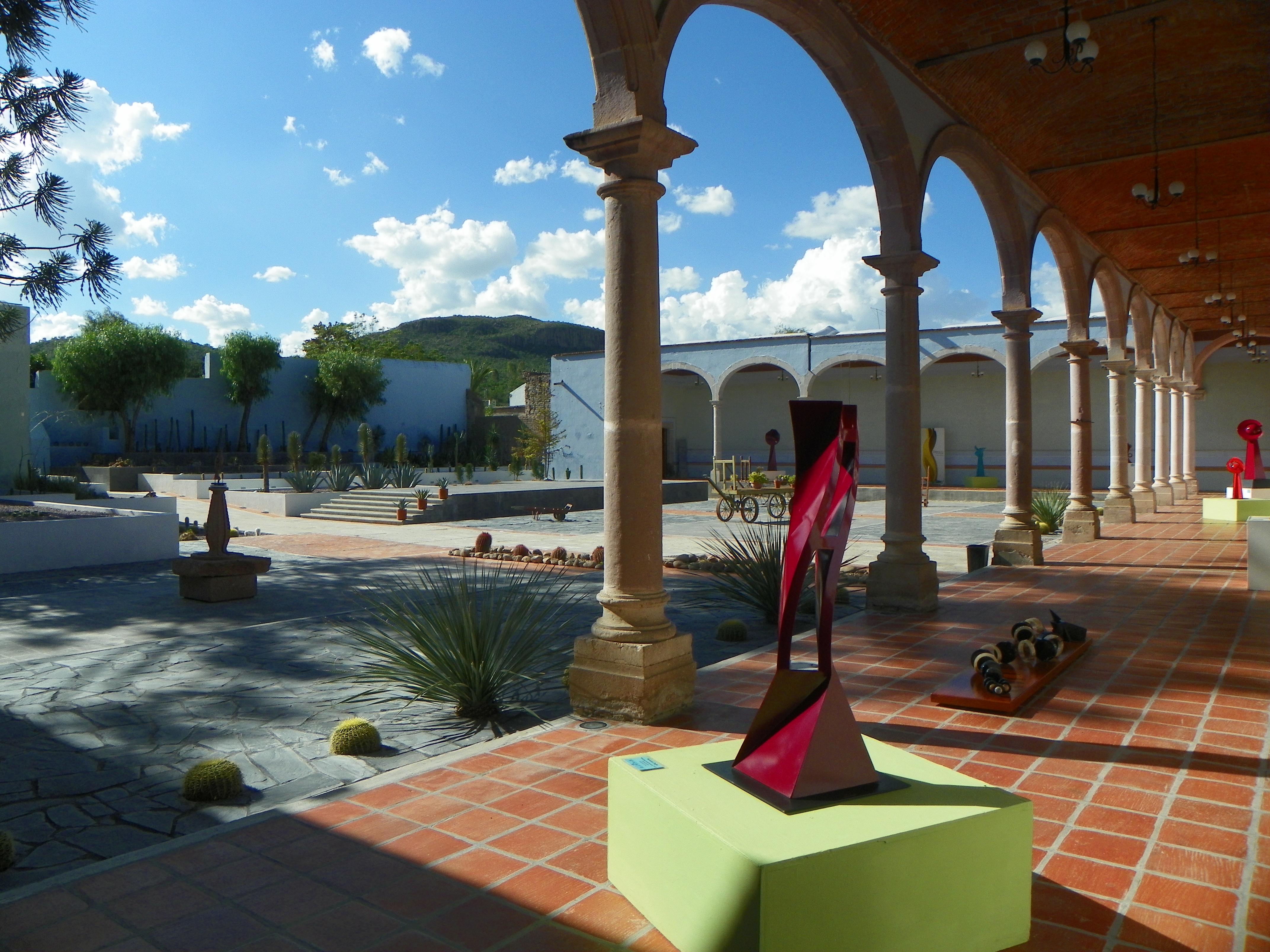
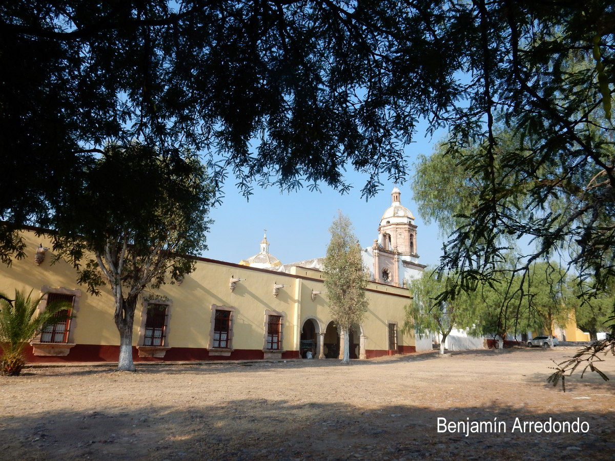
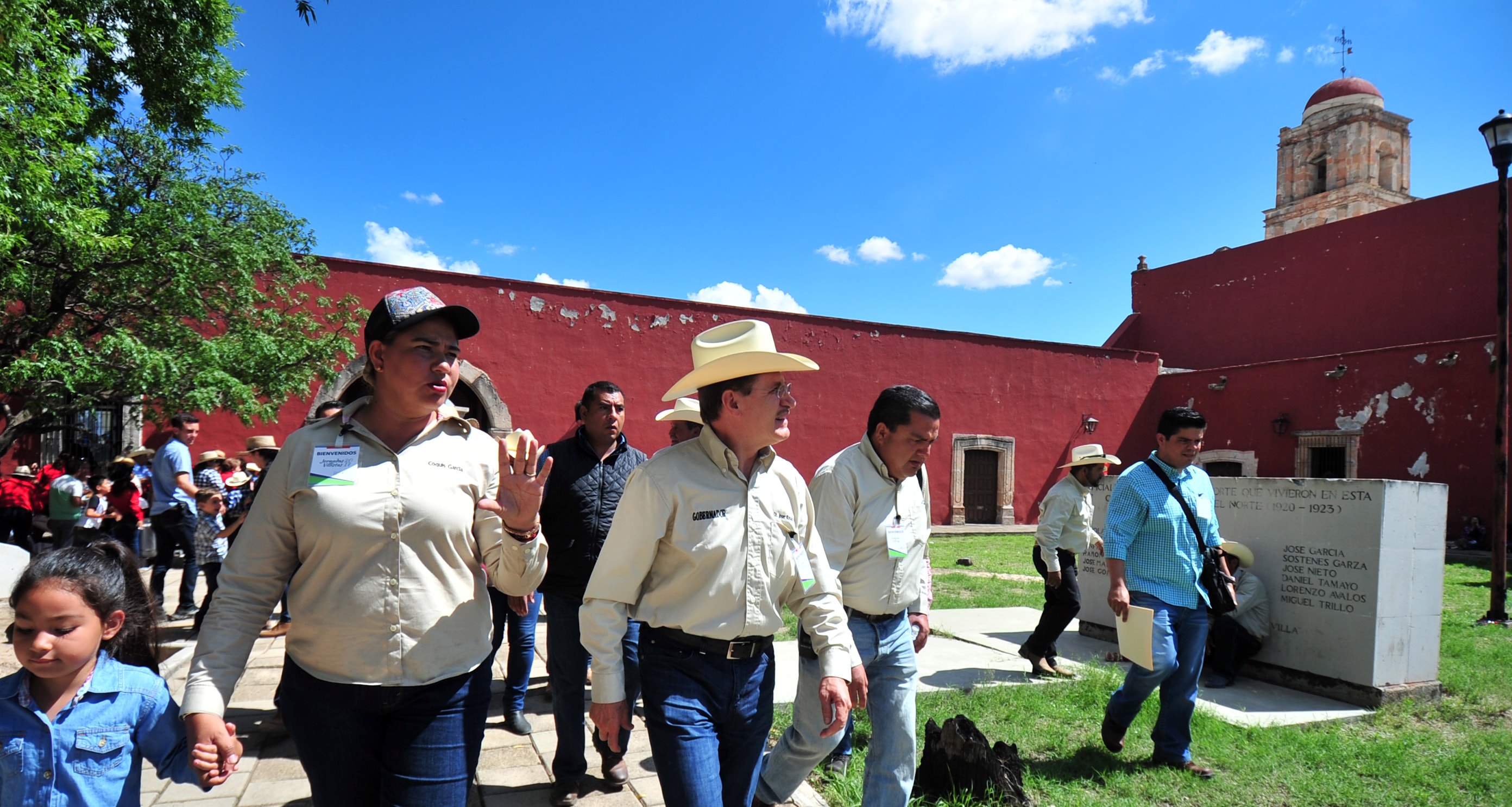
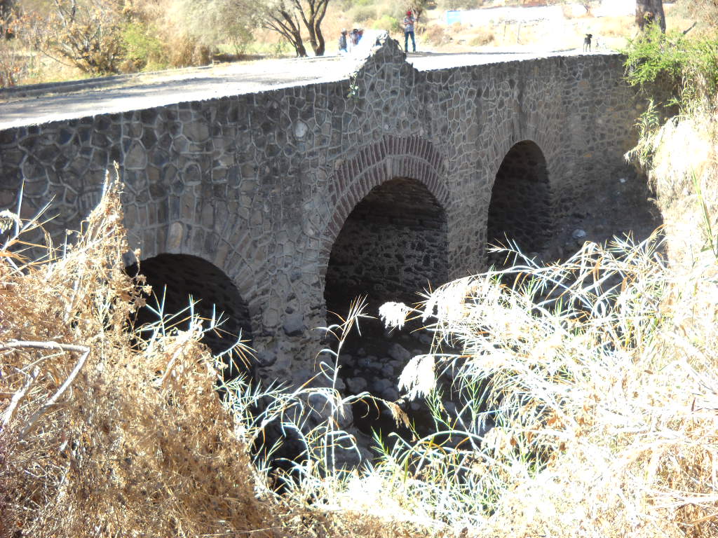
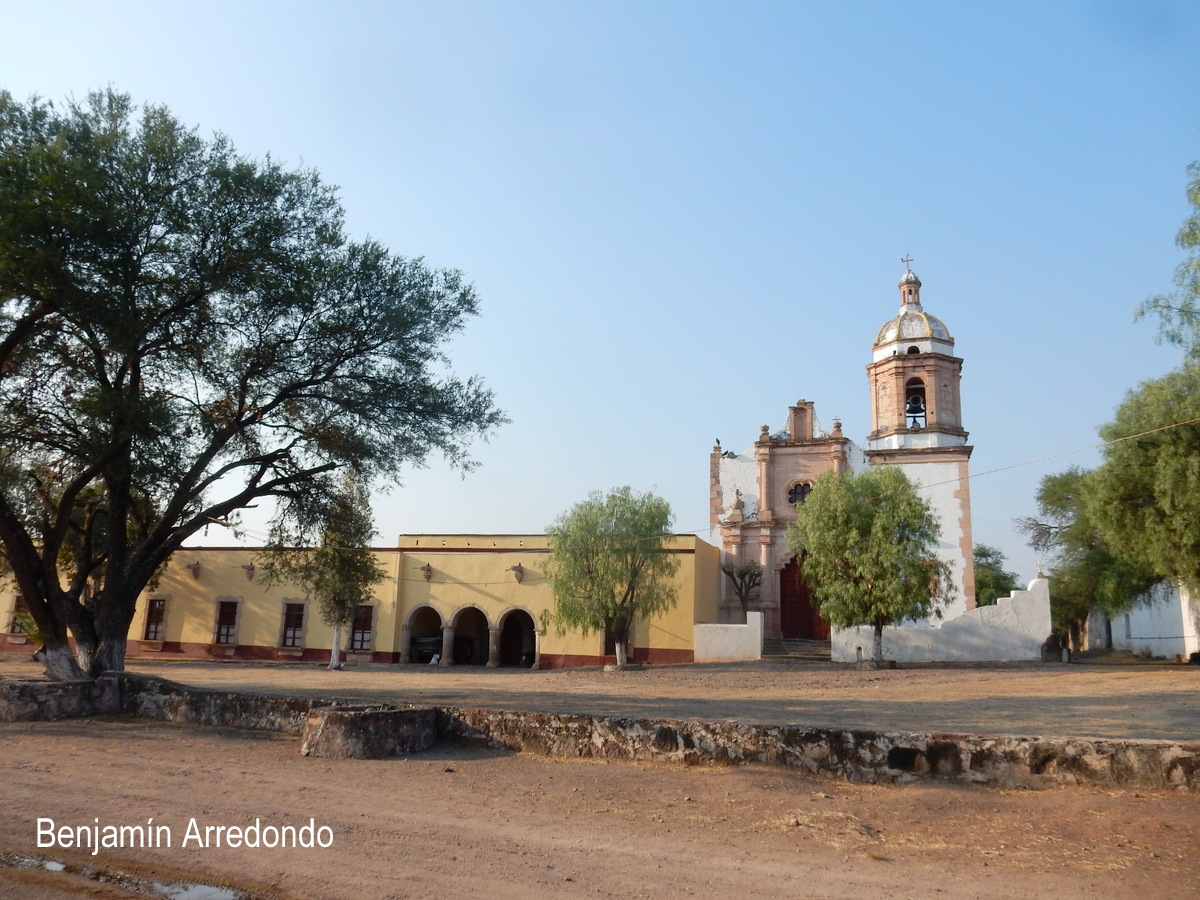
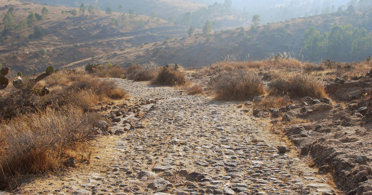
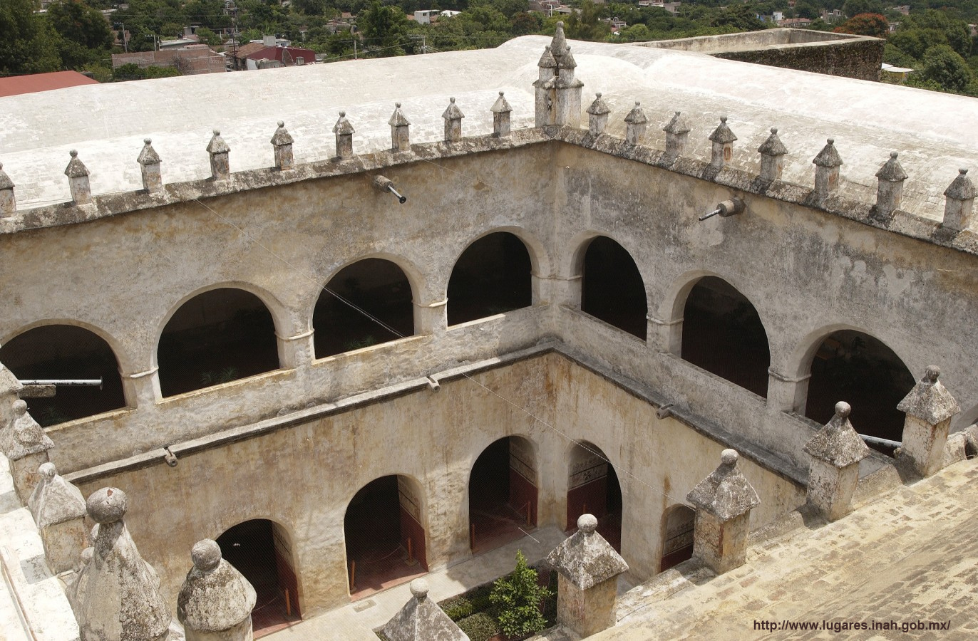
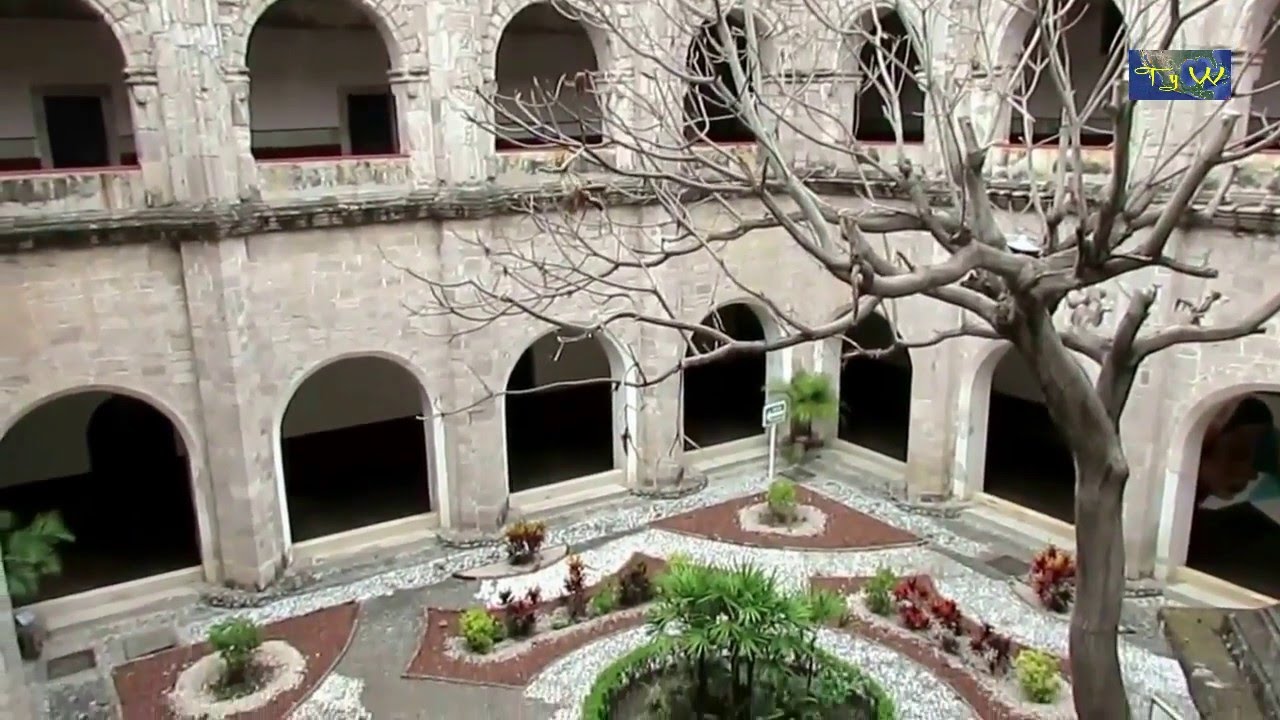
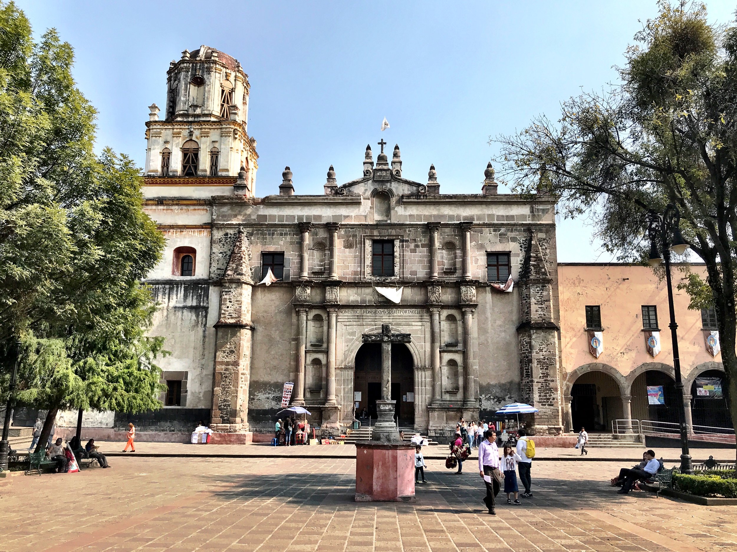
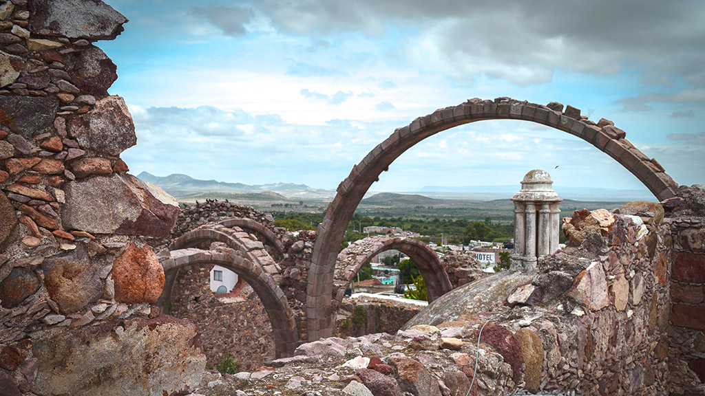
The beautiful estancia is located in the municipality of El Marques, Queretaro. It was founded by the Spanish monks of the Discalced Carmelites to evangelize the indigenous people. At the moment it continues dedicated to the agricultural and cattle production, mainly to the agricultural activity.
Historic Monuments Zone of Queretaro @
The old colonial town of Queretaro is unusual in having retained the geometric street plan of the Spanish conquerors side by side with the twisting alleys of the Indian quarters. The Otomi, the Tarasco, the Chichimeca and the Spanish lived together peacefully in the town, which is notable for the many ornate civil and religious Baroque monuments from its golden age in the 17th and 18th centuries.
Historic centre of San Juan del Rio
It was founded as villa in 1531 with the goal of establishing, together with the villa of Santiago, a frontier to safeguard Spaniards during their battles against Chichimeca groups.
Franciscan Mission Parroquia de Santiago Apostol in Jalpan de Serra at Benito Juarez, Independencia
This complex is situated in the center of the modern town in front of the main plaza and formed by an atrium, cloister, pilgrim portal and church, with a chapel annex on the left side. The original atrium wall was lost, but reconstructed in the same style, with three portals and inverted arches. The main features of the ornate portal on the facade are Our Lady of the Pillar and the Virgin of Guadalupe, both with Mesoamerican connections, as well as a double headed eagle, meant to symbolize the blending of the two cultures.
Franciscan Mission Conca in San Juan on Guerrero Street
San Miguel Concá is the furthest north and the smallest of the missions. The decoration features large flowers, foliage and coarse figures in indigenous style. It is distinguished by an image of the Holy Trinity at the crest along with a rabbit (a Pame symbol) and double-headed eagle.
Franciscan Mission Santa Maria in Landa de Matamoros at San Esteban
The mission was built between 1760 and 1768 by Miguel de la Campa is dedicated to Our Lady of the Immaculate Conception, which gives rise to part of the community’s name. It was the last of the missions to be built. The atrium is bordered by a wall and centered by a cross, and paved in stone. It is noted for its equilibrium in composition and very narrow bell tower, which is integrated into the facade. The sculpture of this facade is considered to be the best of the five according to Arqueología Mexicana magazine. The faces of the mermaids at Landa have indigenous features.
Franciscan Mission in Tilaco
Tilaco is the best conserved of the five missions and has the most subtle ornamentation on its fassade. Its fassades are composed of three horizontal and three vertical partitions, with the Franciscan coat of arms prominent over the main entrance. In Tilaco, the fassade has small angels, ears of corn and a strange large jar over which is an image of Francis of Assisi. One distinctive decorative element is four mermaids with indigenous features.
Franciscan Mission Nuestra Senora de la Luz in Tancoyol
The structure is similar to those in Jalpan and Landa. It has a church with a Latin cross layout and choir area, a sacristy, atrium with cross and chapels in the corners of the atrium called "capillas posas". There is also a pilgrims' gate, a cloister and quarters for the priest. The interior has a number of sculptures including one of “Our Lady of Light.” The facade is marked by a rhomboid window surrounded by a representation of the cord Franciscans use to tie their habits.

Quintana Roo state [capital = Chetumal]

Sian Ka'an in Felipe Carrillo Puerto @
The property boasts diverse tropical forests, palm savannah, one of the most pristine wetlands in the region, lagoons, extensive mangrove stands, as well as sandy beaches and dunes. The 120,000 hectares of marine area protect a valuable part of the Mesoamerican Barrier Reef and seagrass beds in the shallow bays. The lush green of the forests and the many shades of blue of the lagoons and the Caribbean Sea under a wide sky offer fascinating visual impressions.

San Luis Potosi state [capital = San Luis Potosi]

Historic centre of San Luis Potosi see detail
Standing at 2,000 meters (6,000 feet), it's often regarded as the highest metropolis in the country. The city is also famous for its silver mining roots and the significant revolutions that took place. You can revisit the eventful history through the many colonial buildings and museums.

Sonora state [capital = Hermosillo]

Colorado River Delta in El Golfo de Santa Clara at Reserva de la Biosfera Alto Golfo de California y Delta del Río Colorado
Energized by some of the greatest tides in the world, this area includes the expansive delta of the once mighty Colorado River and numerous wetlands and estuaries, which serve as nursery grounds for marine species and resting places for resident and migratory birds. The area is known for its many endemic species, as well as commercially important populations of shrimp, blue crabs and clams. It is home to four highly endangered species including the endemic Gulf of California harbor porpoise or vaquita and the totoaba.
El Pinacate and Gran Desierto de Altar Biosphere Reserve in Puerto Penasco @
The volcanic shield in the property boasts a wide array of volcanic phenomena and geological formations, including a small shield-type volcano. The most visually striking feature is the concentration of a total of 10 enormous, deep and almost perfectly circular Maar (steam blast) craters, believed to originate from a combination of eruptions and collapses. The property is visually outstanding through the stark contrast of a dark-coloured area comprised of a volcanic shield and spectacular craters and lava flows within an immense sea of dunes. The dunes can reach 200 meters in height and contain linear dunes, star dunes and dome dunes, displaying enormous and constantly changing contrasts in terms of form and color. In addition to these predominant features there are several arid granite massifs emerging like islands from the sandy desert flats, ranging between 300 and 650m high. The combination of all these features results in a highly diverse and visually stunning desert landscape.
Tiburon + San Pedro Martir Islands via Punta Chueca @
The Tiburon island is uninhabited (except for Mexican military encampments on the eastern and southern shores of the island) and is administered as an ecological preserve by the Seri tribal government in conjunction with the federal government. San Pedro Martir is seldom visited, having near vertical sides leaving only questionable fair weather anchorages in two locations.

Veracruz state [capital = Xalapa]

Historic Monuments in Tlacotalpan @
Tlacotalpan, a Spanish colonial river port on the Gulf coast of Mexico, was founded in the mid-16th century. It has preserved its original urban fabric to a remarkable degree, with wide streets, colonnaded houses in a profusion of styles and colours, and many mature trees in the public open spaces and private gardens.
Pre-Hispanic City in Papantla at El Tajin
Its architecture, which is unique in Mesoamerica, is characterized by elaborate carved reliefs on the columns and frieze. The 'Pyramid of the Niches', a masterpiece of ancient Mexican and American architecture, reveals the astronomical and symbolic significance of the buildings. El Tajin has survived as an outstanding example of the grandeur and importance of the pre-Hispanic cultures of Mexico.

Yucatan state [capital = Merida]

Pre-Hispanic City of Chichen-Itza in Tinum @
This sacred site was one of the greatest Mayan centres of the Yucatan peninsula. Throughout its nearly 1,000-year history, different peoples have left their mark on the city. The Maya and Toltec vision of the world and the universe is revealed in their stone monuments and artistic works. The fusion of Mayan construction techniques with new elements from central Mexico make Chichen-Itza one of the most important examples of the Mayan-Toltec civilization in Yucatán. Several buildings have survived, such as the Warriors’ Temple, El Castillo and the circular observatory known as El Caracol.
Pre-Hispanic Town in Uxmal on Carretera Federal No. 261
Even before the restoration work, Uxmal was in better condition than many other Maya sites. Much was built with well-cut stones set into a core of concrete not relying on plaster to hold the building together. The Maya architecture here is considered matched only by that of Palenque in elegance and beauty. The Puuc style of Maya architecture predominates. Thanks to its good state of preservation, it is one of the few Maya cities where the casual visitor can get a good idea of how the entire ceremonial center looked in ancient times.
Pre-Hispanic Town of Kabah
The most famous structure at Kabah is the "Palace of the Masks", the fassade decorated with hundreds of stone masks of the long-nosed rain god Chaac; it is also known as the Codz Poop, meaning "Rolled Matting", from the pattern of the stone mosaics. This massive repetition of a single set of elements is unusual in Maya art, and here is used to unique effect.
Pre-Hispanic Town of Sayil
The Great Palace has an 85-meter-long facade and is built upon a two-terraced platform, giving the impression of three stories. Various rooms are arranged around the four sides of each terrace. The uppermost terrace supports a long structure with a single range of rooms. The palace was built in various phases through an unknown period of time in the Terminal Classic; wings were added and platforms were designed, which were filled with stones and mortar to increase stability. The palace has a central stairway on the south side, giving access to the upper levels of the building.
Pre-Hispanic Town in Labna at Carretera Uman - Hopelchen km 101
The site is a comparatively small and compact one. Among its notable structures is a large two-storey 'palace' ("El Palacio"), which is one of the longest contiguous structures in the Puuc region at approximately 120 m (393.7 ft) in length. From the palace, a ceremonial road (sacbe) extends to an elaborately decorated gateway arch ("El Arco"). This structure is 3 m (9.8 ft) wide and 6 m high, with well-reserved bas-reliefs. The arch is not an entrance to the city, but rather is a passageway between public areas. Next to this gateway stands "El Mirador", a pyramid-like structure surmounted by a temple. Also on the site is the Temple of the Columns.

Zacatecas state [capital = Zacatecas]

Chapel of San Nicolas Tolentino of the former hacienda of San Nicolas de Quijas in Villa Garcia on Mexico 107
An ensemble of sites along the southern part of the Camino Real de Tierra Adentro, including examples of buildings, architectural and technological ensembles, illustrate a significant stage in human history - the Spanish colonial exploitation of silver and the transformation of associated rural and urban landscapes.
Town of Pinos @
See above.
Temple of Nuestra Senora de los Angeles in Noria de Angeles on Ninos Heroes
See above.
Cave of Avalos in Ojocaliente
See above.
Stretch of the Camino Real from Ojocaliente to Zacatecas
See above.
Former college of Nuestra Senora de Guadalupe of Propaganda Fide in Guadalupe on Calle Luis Moya
See above.
Historic centre of Zacatecas see detail
Today, the colonial part of the city is a World Heritage Site, due to the Baroque and other structures built during its mining days
Sanctuary of the Nino de Atocha in Plateros on Calle Hidalgo
This sanctuary is important to the local mining population and has a fascinating history
Historic ensemble in Sombrerete see detail
The town of Sombrerete maintains its colonial era layout with wide streets that connect small streets and alleys dotted with plazas.
Temple of San Pantaleon Martir in La Noria de San Pantaleon, Sombrerete
An ensemble of sites along the southern part of the Camino Real de Tierra Adentro, including examples of buildings, architectural and technological ensembles, illustrate a significant stage in human history - the Spanish colonial exploitation of silver and the transformation of associated rural and urban landscapes.
Mountain Range of Organos in Villa Insurgentes
The park is known for its diverse aridland ecosystem and towering rock formations of the Sierra Madre Occidental, which are reminiscent of organ pipe cactuses or the pipes of the musical instrument, from which the park takes its name
Architectonic ensemble in Chalchihuites
The archaeologist Manuel Gamio referred to Chalchihuites as a “culture of transition” between the Mesoamerican civilizations and the so-called Chichimeca hunter-gatherers who lived in the arid plateau of central Mexico. Chalchihuites and La Quemada were both outposts of Mesoamerican settlement in an ecological and cultural frontier area. However, in this transition zone, climatic changes caused continual shifts in the available resource base, discouraging most attempts at creating permanent settlements.